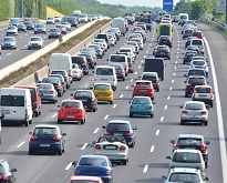
The main influencing factor for a dense motorway network is transport demands. Such demands are particularly high in urban and other densely-populated areas, industrial areas and around major seaports. The highest motorway densities in the EU are found in regions of Germany, the Netherlands as well as in the capital region of Hungary.
Most European capitals and large cities are surrounded by a ring of motorways in order to meet the high demand for road transport. Dense motorway networks are found around capitals such as Budapest (120 km/1 000 km²), Vienna (109 km/1 000 km²), Madrid (96 km/1 000 km²), Prague (91 km/1 000 km²) and Berlin (91 km/1 000 km²). Region sizes vary across the EU with some capitals being designated as regions themselves, such as Vienna, whereas other capitals are parts of a larger region, such as Paris being part of the Île-de-France region. As a consequence, small capital regions in most cases have higher motorway densities compared to larger regions that include a capital. For example, the motorway density of the small Vienna region is higher than the density of the large Île-de-France region, even though Paris has a bigger motorway network than Vienna.
Source dataset: tran_r_net
Other densely-populated regions with high motorway density include the Randstad area in the western part of the Netherlands (Utrecht: 132 km/1 000 km2 and Zuid-Holland: 124 km/1 000 km2), which is of high economic importance.
High motorway densities are also found around some of the main seaports of northern Europe which are vital to support economic activity: the motorway densities of regions of Bremen (205 km/1 000 km²) with the port of Bremerhaven, of Zuid-Holland with the port of Rotterdam (124 km/1 000 km²) and of Hamburg (107 km/1 000 km²) are among the highest of all European regions.
The density of motorways on islands is generally low, as islands cannot be reached directly by road. Instead, they rely on sea or air transport. Even so, the motorway density of the Canary Islands appears relatively high at 37 km per 1000 km².
For more information:
- Statistics Explained article on inland transport infrastructure at regional level
- Dedicated section on transport
- Database on transport
- Dedicated section on regional data
- Database on regional data
Methodological notes:
- In this article, the regional data are presented at NUTS 2 level except for Germany, Lithuania and Portugal (NUTS 1 level). The names of the regions are in English. Estonia, Cyprus, Latvia and Luxembourg are single regions at this level of detail.
- Italy and Luxembourg: 2019 data.
- Greece, Malta, Iceland and Sardegna: data not available.
- Estonia: data on motorways refer to 1st class roads.
- Switzerland: data on motorways cover 4- to 7-lane highways.
- Italy: motorways declared for Provincia Autonoma di Bolzano/Bozen (ITH1) include the network for the Provincia Autonoma di Trento (ITH2). For the purpose of the map, the total area of the two regions has been considered and the density figures have been equally spread between these two regions.
- Poland: motorways for regions Warsaw-Capital (PL91) and Mazowieckie-Regional (PL92) have been declared cumulated at NUTS 1 level Mazowieckie (PL9).
To contact us, please visit our User Support page.
For press queries, please contact our Media Support.

