Make statistical maps with the upgraded IMAGE tool
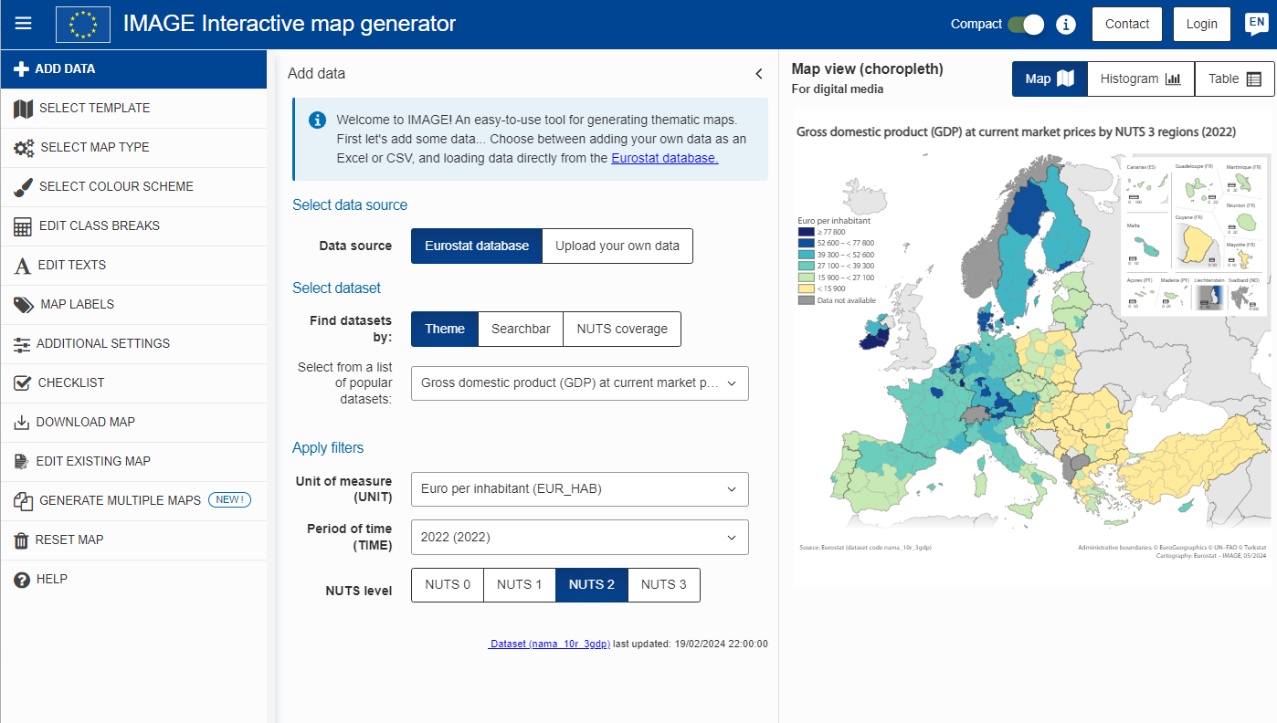
Maps are an effective tool helping readers to quickly grasp complex information while putting it into a geographic context. Most Eurostat maps are prepared using the Interactive Map Generator (IMAGE), a web-based tool created by the Geographic information system of the Commission (GISCO) that allows users to make statistical maps based on our predefined map layouts.
The tool is available for everyone to use free of charge. Users can prepare European maps using the data on the national and regional level. Additionally, the tool allows users to focus on their own country, or opt for a world map. There is an option to upload the data or load it directly from the Eurostat database.
With recent updates, the IMAGE tool is now available in 24 EU languages. Customizable map settings have been extended and its features have been improved to ensure smooth usage and accurate data representation.
To assist you, IMAGE provides a help section, video demonstration and training exercises. To ensure all the requirements to have the perfect map are met and the best practices are followed, there is also a helpful final checklist available in the tool.
For more information
- GISCO overview
- IMAGE tool
- Podcast on Maps - Part I and II
- Webinar 'How to create maps using Eurostat data'
If you have any queries, please visit our contact us page.

