
EMODNET launches new "street view" of the seabed
date: 24/09/2018
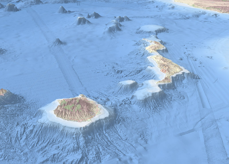
The model is a significant upgrade of the “bathymetry DTM”, a service that visualises the "beds" or "floors" of water bodies, in this case the European Seas. The DTM is useful for a whole range of applications in marine science, ocean governance, and the blue economy.
Reducing risk for public safety and enterprises
Available free of charge, it offers a “street view of the seabed” that helps companies and scientists when tracing out new pipeline trajectories, deciding on locations of offshore wind farms or planning harbour extensions. It enables biologists to draw seabed habitat maps, geologists to study morphological processes and oceanographers to develop their hydrodynamic models.
The DTM helps to reduce risks for coastal and offshore installations, and improves our ability to forecast storm surges.
A very successful product
First launched in 2010, the EMODnet Digital Bathymetry (DTM) has now become a reference for government, science and industry, being by far the most popular EMODnet product. Regularly visited by more than 10 000 persons per month, with over 3 000 downloads per month, it provides the best publicly available gridded bathymetry model for European marine waters.
With the ambition to refine further the quality and the resolution of the DTM, considering both European offshore waters and coastal zones, EMODnet invites potential high-resolution bathymetric data providers to help generate an even better DTM product. Visit the EMODnet Data Ingestion portal (www.emodnet-ingestion.eu) to learn more!