Equipping North Africa to map and protect our shared sea

Related topics
Environment & climate action Innovation Belgium France Italy Spain United Kingdom Switzerland Environment Egypt Morocco Algeriadate: 29/09/2015
Project: Marine Ecosystem Dynamics and Indicators...
acronym: MEDINA
See also: CORDIS
Urban growth and intense maritime activities have led to a decline in marine biodiversity and the degradation of natural areas along the Mediterranean coast. The three-year EU-funded MEDINA project increased the involvement of North African countries in developing solutions to what is a shared ecosystem.
A holistic view of the Mediterranean
“The main goal of this project was to increase the capacity of countries in North Africa to use data in a cost-effective and efficient manner in order to better manage their marine environments and identify ecosystems at risk from climate change,” explains project coordinator Roberto Pastres from the Ca’ Foscari University of Venice, Italy. “This was achieved by making better use of freely available satellite data and combining it with mathematical modelling and site-specific data, gathered by working closely with local partners in the region.”
Limited resources for fieldwork and political instability in some North African countries obliged the team to use remote sensing data from satellites as much as possible. “All indicators produced were then summarised in maps and uploaded for free viewing on the MEDINA geoportal,” says Pastres. “With this innovation, we showed how North African countries can cost-effectively increase their capacity for environmental monitoring.”
The portal is compatible with and accessible through the Global Earth Observation System of Systems (GEOSS) of the Group on Earth Observations (GEO), which links together observing systems from around the world and encourages the development of new systems to address global challenges.
Demonstrating the benefits of satellite mapping
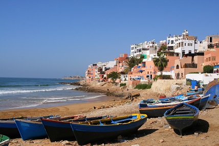
Case studies were carried out in Morocco, Algeria, Egypt, Libya and Tunisia. In Morocco a lagoon ecosystem was closely monitored, while across the border in Algeria, environmental data was applied to identify sites suited to fish farming in line with government objectives. Water quality in the Delta lakes of Egypt was monitored to provide valuable information to the local fishing industry.
“In the Gulf of Gabès off Tunisia, we developed a model for estimating the presence of the seagrass Posidonia oceanica,” explains Pastres. These seagrass meadows – a key spawning ground for marine organisms – have been damaged due to intense fishing activities. MEDINA provided a preliminary estimation of lost ecosystem services in order to address the issue of potential restoration, and the model has subsequently been applied to the whole North African coastline.
“In Libya, basic information concerning ecosystem status is lacking, so we carried out an exploratory analysis based on satellite data,” says Pastres. This analysis sought to identify areas where certain physical parameters are homogeneous, which is a key step towards developing ecosystem-based management. Ongoing conflict in the country meant that fieldwork was not possible.
“Through these case studies, we showed how shared data benefits everyone,” says Pastres. “Another satisfying aspect of this project has been the development of close relationships with our partners in North Africa. Since completion of the project [in December 2014], we have kept in touch; I will be visiting the Morocco case study site in a few months, and my institution will shortly be hosting an Algerian researcher for a year.”
The effectiveness of processing satellite data to produce ecosystem mapping also led to the creation of a spin-off company, which Pastres founded together with French project partners. The business applies satellite data to sustainable aquaculture management, and is currently focusing on mussel, sea bass and prawn farming. Satellite mapping applications will also contribute to studies of the impact of climate change on coastal habitats, helping to identify risks posed by human activities such as tourism and fishing.
