
Scrutinising snow and ice from space
Related topics
Environment & climate action Innovation SMEs Innovation in SMEs Austria Finland Romania Sweden Switzerland Environment Norwaydate: 30/01/2015
Project: GMES Service Snow and Land Ice
acronym: CRYOLAND
See also: CORDIS
Contact: Contact
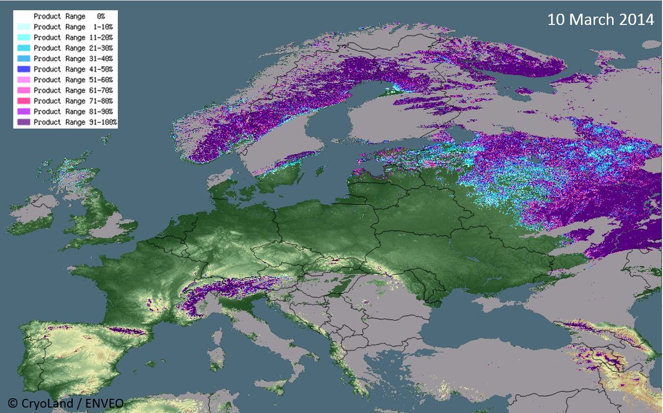
“Snow and glaciers are not just about tourism,” says CryoLand project coordinator Thomas Nagler of engineering company ENVEO, explaining why monitoring both is indispensible. They are important water resources, especially in spring and summer, when snow and ice melts, trickling down to reservoirs. Snow and ice are also indicators of climate change.
On a daily basis, snow and ice updates are needed by stakeholders as diverse as hydropower companies, hydrological and meteorological service providers, climate monitoring bodies, environmental agencies, road, rail and river authorities, geotechnical construction companies, avalanche warning centres and ecologists.
To provide these potential users with the information they need, the CryoLand project has developed a process to first receive data from a network of satellites, to combine it with ground-based measurements, and then to make this data accessible in customised online applications.
CryoLand will ultimately use data from the EU’s Copernicus space programme – a fleet of satellites and ground stations being developed to monitor the environment. In the meantime, the team has been relying on other satellites. “Since the launch of Sentinel-1 in April 2014 – the first of a series of European Sentinel satellites – we have radar data of an excellent quality and extended temporal and spatial coverage,” he says.
The satellite data are processed applying algorithms and automated techniques developed by the CryoLand team, which calculate – for example – the extent of snow coverage and snow melt area.
Real-time information
What makes the applications so precious is not only their accessibility and accuracy, but also the speed with which they make information available. The CryoLand system checks continuously for new satellite data, downloads the data and begins generating the applications.
The product – be it a snow coverage map or details of lake ice – is then ready for customers within a few hours after image acquisition. The information is therefore available when those who need it begin checking early the next morning. The goal is to have an automated system by the end of the project in January 2015, and the team is well on track.
Users benefit from direct access to the very specific information they need, avoiding the need to download enormous files containing only small amounts of relevant data.
Some 60-70 user organisations have been involved in the project from the beginning. They helped define products and services, supplied feedback on various prototype products and have been testing the applications over the last two winters. This feedback helps to optimise algorithms and services, to ensure the services deliver the information needed. The project is now in the demonstration phase, providing automatic services on snow, glaciers, lakes and rivers.
The significance of the CryoLand applications has not gone unnoticed. The European Space Agency, the European Environment Agency and commercial companies are all following the project with interest, while talks are underway on a follow-up project that Nagler hopes will extend his team’s snow and glacial services.
From the Alps to the Himalayas
In Europe, users of glacier data are primarily based in Alpine regions or Scandinavia. But the appeal of the applications extends to further afield. In South America and the Himalayan region, glacial lakes are of particular interest. They are often in very remote regions, making them difficult to monitor. But remoteness doesn’t diminish the impact on people and infrastructure further down the valley if the ice melts faster than usual – or if the water supply dries up.
In addition to providing immediate information on water supply and potential hazards, monitoring snow and ice can also provide valuable insights into climate change. “Snow and glaciers are very sensitive to the climate,” explains Nagler. CryoLand has produced daily ‘snow extent’ maps for Europe from the year 2000 until the present day. How snow and glaciers retreat from year to year is important for climate scientists, and many are poring over the CryoLand data.
All applications and products can be accessed via the project website. Access is currently free of charge, although Nagler hopes that the project will one day be able to make money from its results.