
Putting health risk on a map
Related topics
Environment & climate action Belgium France Germany Netherlands Spain United Kingdom Climate action Environment Climate action, environment, resource efficiency and raw materials Mozambique Uganda South Africadate: 20/08/2014
Project: Earth Observation and ENVironmental mode...
acronym: EO2HEAVEN
See also: CORDIS
Contact: Contact
Making a link between environmental conditions and health is not new, but previous data contained gaps, explains EO2HEAVEN project coordinator Kym Watson of Germany’s Fraunhofer Institute of Optronics, System Technologies and Image Exploitation.
For example, while health workers may use simple environmental data such as temperature to assess health risk, they rarely use geospatial (location) data and do not look at maps to visualise risk, Watson explains.
His project put health and environmental data together – no simple task since they come in different formats – to create maps showing the correlation between time and health events in three locations:
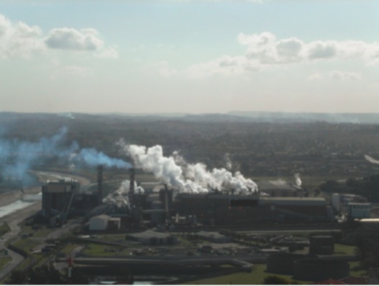
- Dresden, Germany: temperature, particulate matter and ozone levels – cardiovascular disease;
- Durban, South Africa: air pollution – asthma;
- Uganda: various environmental factors – cholera outbreaks.
The problem with privacy
While Germany may have the most advanced data collection infrastructure, creating a health risk map for the city of Dresden posed its own problems – in particular accessing medical data protected by strict privacy laws. But Watson is undeterred, and suggests health staff with data access could themselves use the EO2HEAVEN system to visualise impending risk.
By the project end in May 2013, the team had created a system to produce maps showing air pollution and risk, along with a methodology for displaying cardiovascular incidences on the same map. Everything has been passed on to the region’s Spatial Data Infrastructure, which is using the system to assess risk incidences.
In Durban the team’s early warning system, based on air quality, is today being used by the Department of Pollution Control and Risk Management of the eThekwini municipality. It provides early warning of likely respiratory problems and helps environmental health practitioners resolve complaints. An unexpected benefit has been the highlighting of gaps in local air quality data collection. It is now also being used to identify where new measurement stations are needed – four are in place already.
Stopping cholera in its tracks
Uganda presented challenges of a different scale, with no measurement stations and very limited health data. The focus was also different – instead of a system to warn of risk for people with specific vulnerabilities, the team worked on a map to visualise how cholera is likely to spread.
Rain, moist soil and warm water temperatures create the perfect conditions for cholera bacteria, and the team found that the disease tends to spread between villages connected by road.
Once the first case is detected, authorities need to react within a week to prevent a serious outbreak. They can warn the population and provide clean water, launch an immunisation campaign and/or prepare medical staff, reducing the outbreak’s scope in time and area.
Incidences are recorded on a piece of paper that could take five days to reach authorities. But the same process could take a matter of seconds using the EO2HEAVEN smartphone app. A prototype is up and running, while the app must simply be integrated into Uganda’s health system for it to revolutionise cholera reporting.
The EO2HEAVEN team has also been working closely with the World Health Organisation (WHO) and the US’ National Oceanic and Atmospheric Administration (NOAA), building on EO2HEAVEN experience and knowledge, to create an early warning system for Uganda and other countries where cholera is a problem. Together, they are hoping for new financing to take the project forward.
Geospatial data from space
Environmental data from satellites can supplement data traditionally collated by ground stations or may even be the only possibility, especially in developing countries.
Although weather conditions meant satellites weren’t always practical for this project, Earth observation has great potential in this area, says Watson. For example, it can be used to gauge large-scale environmental factors, such as rainfall over a large area.
EO2HEAVEN’s work on Earth observations led the team to contribute to the work of the Group on Earth Observations (GEO) on health – it is working with the health community to improve the flow of environmental data.
Watson puts much of the project’s success down to the team’s cross-disciplinary nature. “This was necessary to make the project a success, but it was also a challenge to get people to communicate, to explain what they need and how their models work, etc.,” he says. The team included environmental scientists, IT experts, microbiologists, medical specialists and epidemiologists, to name a few. But coordination went smoothly, says Watson, himself a mathematician!