
Back from the depths of Whittard Submarine Canyon
date: 22/09/2015
Project: COmplex Deep-sea Environments: Mapping h...
acronym: CODEMAP
See also: CORDIS
You just came back from a 5-week research expedition. What was the aim of it?
Our purpose was to map and investigate the Whittard Submarine Canyon in the Bay of Biscay, in order to obtain a full, 3-dimensional picture of its habitats. Submarine canyons are some of the most complex deep-sea environments on this planet and are known to be potential biodiversity hotspots. However, similar to canyons on land, they can have steep flanks, with vertical cliffs and overhanging rock formations, which makes them difficult to study, and has made them the 'forgotten habitats' of the deep sea. With this expedition, we wanted to better understand the biodiversity patterns in the canyon, and the processes that drive them.
You used the latest technologies to explore this particularly rich and challenging environment. What were they?
Traditional 'over-the-side' types of marine equipment, like cores, towed video cameras and ship-borne echosounders cannot reach such complex submarine landscape. So we used a unique combination of shipboard and robotic observations. We simultaneously deployed three different deep-water robotic vehicles: the latest technology in deep-sea research. Thanks to a new development to the NERC Autonomous Underwater Vehicle (AUV) Autosub6000 we could use a sideways-directed echosounder to map the vertical walls during a series of pre-programmed missions. At the same time, we used the tethered Remotely Operated Vehicle (ROV) Isis to record High Definition video data, and to collect biological and geological samples from vertical and overhanging locations. During the expedition, a third type of robotic vehicle, a submarine glider supplied by the University of East Anglia (UEA), continuously measured the water column. The Whittard Canyon has proved to be a highly dynamic environment, with strong, internal, tidal flows and deep plumes of organic-rich sediment focussed in the upper branches, so it was key to study these oceanographic processes.
What are the most striking images you keep of your voyage today?
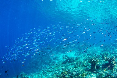
The results from these operations are exceptional. The geomorphology of this canyon is spectacular: we have mapped cliffs up to 150m high and 1.6km long, in some locations down to centimetre-scale resolution. The Seaglider collected a fantastic dataset and revealed the presence of internal waves up to 80 m high. These processes are likely to have a major influence on the distribution of habitats and fauna within the canyon. Our vehicles also imaged rich communities of cold-water corals, clams, deep-sea oysters and their associated fauna, including a broad range of fish species.
And last but not least, for the first time, we were able to image all the seabed processes in a submarine canyon at the scale they occur, and establish the link between those scales. It is the first time we truly can zoom from a canyon-wide map all the way down to the individual polyp of a cold-water coral.
The robots also spotted unexpected marine species in the area:
Yes, there was huge excitement on board as many people got a glimpse of a Blue Whale, but only later did we realise that this is probably the first to be photographed within English waters. The Biscay margin is already recognised as a hotspot for other whales, dolphins and seabirds - our new data further underline the importance of this area for iconic marine life. We also captured amazing footage of Blue Sharks and Swordfish when the ROV was travelling to and from the seabed.
This expedition was an ambitious goal. What are the next steps for the CODEMAP team?
The expedition to the Whittard Submarine Canyon has been, indeed, a challenging and enriching experience. It was part of the CODEMAP project, funded by the European Research Council, and received additional support from the NERC MAREMAP programme and DEFRA. Participants included researchers from the National Oceanography Centre (Southampton), University of East Anglia, University of Southampton, CEFAS, the British Geological Survey, IFREMER, National University of Ireland, Galway, and University of Aveiro.
As part of the CODEMAP project, we have now successfully developed new methodologies for mapping vertical and overhanging substrates in deep water for both AUVs and ROVs. This makes us the only group in the world who currently can image vertical cliffs in the deep sea in this way.
We will now analyse the information collected by the survey team. This will help us guide development of future management measures for this site, as part of the Whittard Canyon study area lies within a new Marine Protected Area, called The Canyons Marine Conservation Zone (MCZ).
Researcher’s webpage - CODEMAP project cruises
CODEMAP result: A new, automated method for classifying hundreds of kilometres of the deep sea floor
Expedition blog
On Twitter: @codemap2015
More at ERC website