
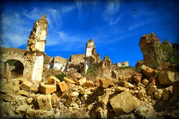
Seismic map for safer buildings
date: 19/12/2014
Project: Seismic hazard harmonization in Europe
acronym: SHARE
See also: CORDIS
Contact: Contact
Seismic hazard’ defines the likelihood of a certain level of ground-shaking occurring during an earthquake (while ‘seismic risk’ defines the probability of damage from an earthquake – an uninhabited area might be high hazard but low risk, for example).
The SHARE project developed a state-of-the-art complete hazard model for Europe and Turkey. The model maps where ground shaking is possible at frequencies relevant for single storey to high-rise buildings, as well as critical infrastructures. The different colours on the project’s 2013 European Seismic Hazard Map display the maximum amount of ground shaking expected to be reached or exceeded with a 10% probability in 50 years – that is, these amounts are forecast to occur on average every 475 years.
Individual countries carry out their own seismic assessments, but the frequency of these assessments varies, explains Jochen Wössner of the Swiss Seismological Service/ETH Zurich – the SHARE team’s project manager.
There is also considerable variation between the various analyses of seismic hazard, starting at the data compilation level. This is very evident in border regions, where hazard is rated differently on one side of the border to the other, even though geological characteristics are very similar.
Perceptions of standard hazard are used to determine building regulations, so accuracy is paramount.
Seismic shift in earthquake modelling
The team used three newly compiled datasets to create the earthquake activity model:
- a catalogue of previous earthquakes in Europe and Turkey dating back to 1 000 AD;
- the first-ever European database of active faults and subduction zones (places were the Earth’s plates come together) in Europe;
- a model of strain rates depicting the long-term deformation of the Earth’s crust – a measure of how fast the Earth’s outer layer moves and accumulates energy when subjected to tectonic forces.
Using data on ground shaking from European databases and elsewhere, the first harmonised European strong motion (motion strong enough to damage a building) database was assembled, SHARE developed the first unified ground motion model for the Euro-Mediterranean region.
The model describes how the amplitude of ground shaking diminishes with distance from the earthquake rupture, depending on the magnitude and type of earthquake.
The combination of the earthquake activity and ground motion models make the SHARE model pioneering, says Wössner: it provides the first-ever homogenous reference seismic hazard model, rigorously quantifies the uncertainties of estimates, and is backed by the expertise of more than 250 key experts, from seismologists and geologists to historians and engineers. The model sets a standard for future projects seeking to estimate seismic hazard.
Towards a safer buildings
“We wanted engineers to be included in the project so that the results fed real needs,” says Wössner. The approach seems to have worked – the model is available for download online and has been in constant use. Engineering and insurance companies, together with academics, account for the majority of users.
Since the SHARE project concluded in November 2012, some countries have begun reassessing their seismic hazard, while others are revising their own models.
The model is likely to trigger further research, and will also contribute to the safer design of buildings in areas prone to earthquakes. For example, the model will be used to update Eurocode 8, Europe’s safety regulations to ensure buildings are designed to be resistant to earthquakes, says Wössner.
The SHARE results have also made their way into schools via the SeismoatSchool initiative, supported by the EU-funded NERA project. Students around Europe can now be found poring over SHARE maps that show potential ground motion, active faults and previous earthquakes.