
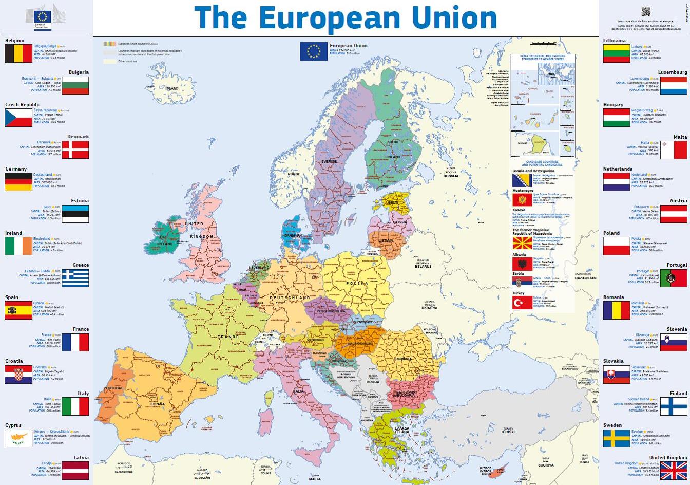
Wallchart featuring a map of Europe
date: 02/02/2017
The wallchart is now available in all languages. The map is not folded, so you might need to ensure that you have poster tubes in stock for distribution. NA-02-15-471-**-P
Background about maps of Europe
DG Communication produces a number of geographical maps of the European Union. They can be used by anyone working in information and communication wanting to publish an accurate geographical map. We include these maps in our own publications, but also offer the files free of charge or copyright restrictions to other communicators. We continuously ensure that the content is correct and up-to-date.
The most frequently used map of the EU is designed to be viewed as a 15 x 15 cm image within an A4 page or on a computer screen.
The standard version of the map is multilingual. This means that the names of the countries are written in their own language.
These maps now exist in each of the 24 official EU languages. We have also produced maps showing which countries use the euro and details of when each country joined the EU. More detailed geographical maps are also available.
Should you wish to tailor our maps to your own specific requirements, we can provide you with the original image files and a technical manual guiding you through the steps to take.
You can download the most popular map images directly from the Commission's audiovisual library.
Get them here and here
Other formats and files of maps of Europe are available for reproduction, upon request.
Contact: Comm-Info-Publications@ec.europa.eu
Webmasters working in EU institutions might be interested in the corporate web-map project, which offers an easy way to incorporate correct maps on websites. Read about it here (this requires login by a Commission official).
A printed map measuring 43 x 47 cm can be found in the 'Travelling in Europe 2016-17' leaflet.