
Maps that support disaster risk management worldwide
date: 05/10/2022
Disasters affect population, land and infrastructure. In some cases, they can be predicted, but the humanitarian and economic effects can be enormous. Providing situational awareness to disaster management teams as quickly as possible allows them to properly distribute resources across affected areas to save lives without putting others at risk.
The Rapid Mapping team of the Copernicus Emergency Management Service (CEMS) provides products in the form of ready-to-print maps and geospatial data. These can be produced within hours or days of a request to support emergency management activities in the immediate aftermath of a disaster like a flood, an earthquake or an industrial accident.
Other —pre-disaster and post-disaster — maps can also be delivered by CEMS’ Risk and Recovery team. They deliver information on hazard, exposure, vulnerability, risk, and mitigation measures that can help users with their specific crisis management tasks. Some maps can support recovery measures to re-establish the social, economic and environmental conditions of a community or geographical area.
 |
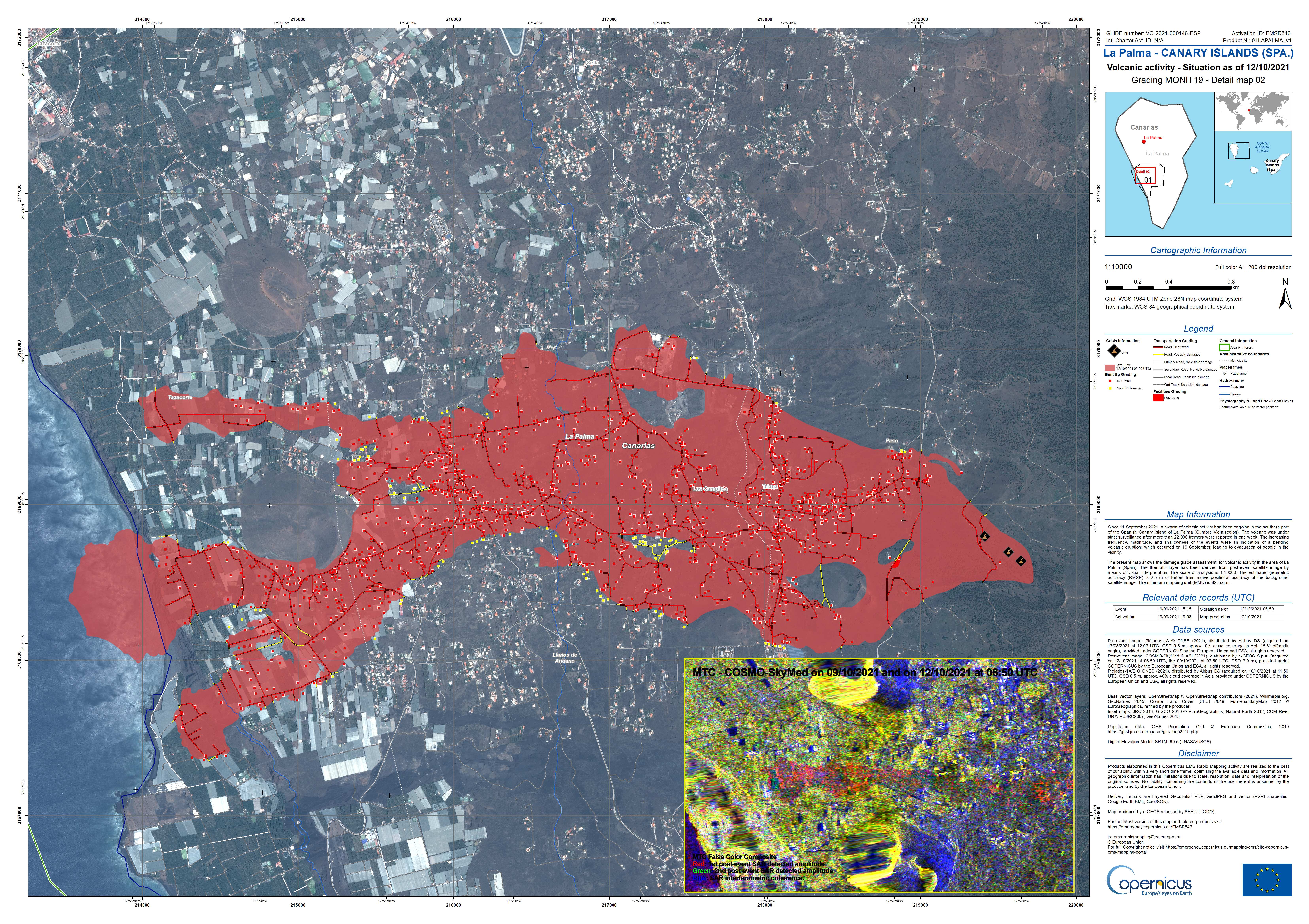
| Map showing the extent of the lava flow and identified damage to buildings, roads and facilities following volcanic activity in the area of La Palma (Spain) in 2021. Available here. © CEMS, EU |