File:Distribution of the utilised agricultural area, Luxembourg, 2005 and 2007.PNG
No higher resolution available.
Distribution_of_the_utilised_agricultural_area,_Luxembourg,_2005_and_2007.PNG (773 × 359 pixels, file size: 37 KB, MIME type: image/png)
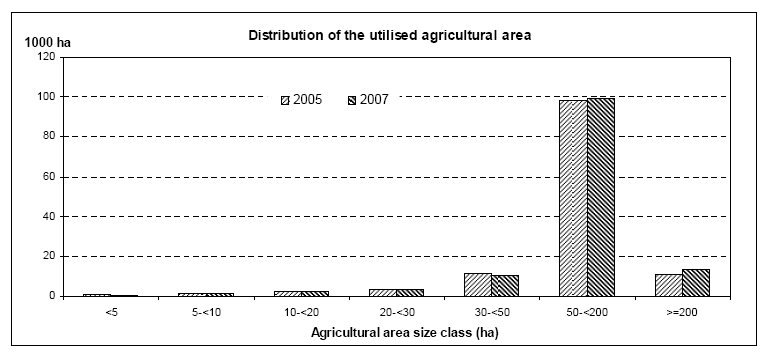
Distribution of the utilised agricultural area, Luxembourg, 2005 and 2007
Graph created with data from October 2008
Most recent data available now, see:
File usage
The following page uses this file: