Farm structure (ef)

National Reference Metadata in ESS Standard for Quality Reports Structure (ESQRS)

Compiling agency: Hungarian Central Statistical Office (HCSO)


Eurostat metadata
Reference metadata
1. Contact
2. Statistical presentation
3. Statistical processing
4. Quality management
5. Relevance
6. Accuracy and reliability
7. Timeliness and punctuality
8. Coherence and comparability
9. Accessibility and clarity
10. Cost and Burden
11. Confidentiality
12. Comment
Related Metadata
Annexes (including footnotes)


For any question on data and metadata, please contact: Eurostat user support

Download


1. Contact Top
1.1. Contact organisation
Hungarian Central Statistical Office (HCSO)
1.2. Contact organisation unit
Agriculture and Environment Statistics Department (AESD)
1.5. Contact mail address
Keleti Károly utca 5-7. HU-1024 Budapest


2. Statistical presentation Top
2.1. Data description
1. Brief history of the national survey 
The first agricultural census was implemented in Hungary in 1895 followed by censuses in 1935, 1956-1957, 1972, 1981 and 1991. Agricultural Census 2000 (AC 2000) was the first one compliant with the relevant EU regulations. Before accession to the European Union Farm Structure Survey 2003 was carried out in line with the EU regulations. Hungary as an EU Member State implemented Farm Structure Survey (FSS) in 2005, 2007, 2010, 2013 and 2016.

In case of censuses an Act provides the legal background, while interim surveys are part of the annual data collection system which is a Government Decree in Hungary.

Agricultural enterprises are part of the business register of HCSO updated continuously with data transmitted from the Registry Court. The register of private holdings is updated fully on the basis of censuses and partly when interim surveys are carried out.

For the implementation of FSSs the combination of exhaustive and sample survey is used. Agricultural enterprises (units with legal entity) always observed on full scope while regarding private holdings (units without legal entity) based on their size surveys are carried out on full scope and representative basis.

For agricultural enterprises it is compulsory to report their agricultural activity via internet from 2013.

Compared to FSS 2013 two new elements were introduced regarding the data collection of private holdings in 2016:

  1. in case of private holdings enumerators mainly carried out computer assisted face-to-face interviews (CAPI) by using tablet or laptop. (Part of the private holdings provided data electronically via internet with self-filling method as in 2013.)
  2. key private holdings (big farms) had to provide their data electronically via internet with self-filling method.

The seven Regional Departments (NUTS 2 level) of the HCSO and County Sections (NUTS 3) belonging to them (these units constitute together the Data Collection Directorate – DCD as of February 2017) are involved in the implementation under the management of the Agriculture and Environmental Statistics Collection Department (AESD).


2. Legal framework of the national survey 
- the national legal framework The Act XLVI of 1993 on Statistics provides the general regulatory framework of surveys implemented in Hungary. Interim farm structure surveys are included in the yearly National Program of Statistical Data Collection (NPSDC) which is a Government Decree, whereas censuses are ruled by an Act approved by the Parliament.
- the obligations of the respondents with respect to the survey The respondents are liable to provide adequate data; in case of refusal, legal action are to be entailed. Data had to be provided by internet (HCSO ELEKTRA system) in case of agricultural enterprises which is a legal obligation according to the Government Decree 279/2012.
- the identification, protection and obligations of survey enumerators Under the Criminal Law enumerators are considered and are entitled to be protected as official person. The HCSO had issued registered identification badges valid only for the duration of the survey together with the ID card.
2.2. Classification system

[Not requested]

2.3. Coverage - sector

[Not requested]

2.4. Statistical concepts and definitions
List of abbreviations
AC 2000 – Agricultural Census 2000

AESD – Agriculture and Environment Statistics Department

DCD – Data Collection Directorate

ADÉL – Uniform Data Entry and Validation System

CAPI – Computer Assisted Personal Interview

CVFP 2001 – Census of Vineyards and Fruit Plantations 2001

EAA – Economic Accounts for Agriculture

ELEKTRA – Internet based self-filling data collection application

E-MEZO – Internet based self-filling data collection application

EUF – European Farm Structure characteristic

FSS – Farm Structure Survey

GÉSA – Data Collection Organisation and Monitoring System of HCSO

HCSO – Hungarian Central Statistical Office

HPA – Hungarian Paying Agency

IACS – Integrated Administrative Control System

KARAT – Integrated data transmission system of HCSO

MA – Ministry of Agriculture (earlier: MARD – Ministry of Agriculture and Rural Development)

MD – Methodological Department

NFCSO – National Food Chain Safety Office

NPSDC – National Program of Statistical Data Collection

NCWC – National Council of Wine Communities

RD – Regional Department

SDC – Statistical Disclosure Control

SI – International System of Units
2.5. Statistical unit
The national definition of the agricultural holding
Agricultural holding is a single unit both technically and economically, which has a single management and which undertakes agricultural activities listed in Annex I of Regulation (EC) No 1166/2008, either as its primary or secondary activity. The survey covers holdings only with land in good agricultural and environmental conditions and no agricultural activity.

Based on their legal entity the target population has two main groups in Hungary: private holdings and agricultural enterprises. 

  • Private holdings: households engaged in agricultural activity reaching or exceeding certain physical thresholds at the reference time of the survey (see the thresholds below - item 2).
  • Agricultural enterprises: legal entities engaged in any kind of agricultural activity or classified as agricultural producer by NACE regardless of its size.

The definition of agricultural holding in Hungary covers also

  • holdings with only forest, fish ponds, reeds, fur animals other than rabbit;
  • holdings providing agricultural services only;
  • agricultural enterprises registered as agricultural producers in the Registry Court but without carrying out any agricultural activity in fact.
2.6. Statistical population
1. The number of holdings forming the entire universe of agricultural holdings in the country
429 995

The holdings above the thresholds (see item 2. below) form the entire universe of the agricultural holdings in Hungary. The households engaged in agricultural activities but under the thresholds are not considered as agricultural holdings.


2. The national survey coverage: the thresholds applied in the national survey and the geographical coverage
Private holdings: According to the physical threshold of the FSS 2016 a private holding on 1st June 2016 uses at least:


Value Denomination  Code
≥ 1500 m² productive land area (including jointly or separately arable land (including nurseries and other permanent crops), kitchen garden, orchard, vineyard, meadow, pasture, forest, fish-pond, reed), and/or A_3_1+B_5_2+fish-pond+reed
≥ 500 m² nurseries and other permanent crops, and/or B_4_5+B_4_6
≥ 500 m² orchards or vineyards, jointly or separately (at least 400 mof fruit trees and 200 m² of berries or vines), and/or B_4_1+B_4_4
≥ 100 m² land area under cover, and/or B_1_7_2+B_1_8_2
≥ 50 m² mushroom area, and/or  B_6_1
≥ 1 head bigger animals, such as cattle, buffalo, pig, horse, sheep, goat, emu, ostrich, donkey, and/or C_1+C_2+C_3_1+C_3_2+C_4+C_5_3_4+emu+donkey
≥ 50 head poultry, jointly or separately, such as hens, geese, ducks, turkeys, guinea fowls, and/or C_5
≥ 25 head rabbits (not just breeding females), furry animals, pigeons for slaughter, and/or C_6+furry animals+pigeons for slaughter
≥ 5 hive bee hives and/or C_7
  agricultural services provided during the previous 12 months  not directly linked to EUF characteristic


Of which: Key private holdings (reaching or exceeding certain physical threshold)

Value Denomination Code
≥ 250 ha arable land, and/or B_1_1+…+B_1_11+B_1_12_1+B_1_12_2 
≥ 17 ha vineyard, and/or B_4_4
≥ 20 ha orchard, and/or B_4_1
≥ 100 ha forest, and/or   B_5_2
≥ 150 ha grassland, and/or B_3
≥ 150 head cattle, and/or C_2
≥ 300 head pigs, and/or C_4
≥ 25 head horses, and/or C_1
≥ 500 head sheep, and/or  C_3_1
≥ 40 head goats, and/or C_3_2
≥ 20 000 head chickens, and/or   not directly linked to EUF characteristic
≥ 5 000 head geese, and/or    C_5_3_3
≥ 10 000 head ducks, and/or   C_5_3_2
≥ 5 000 head turkeys, and/or  C_5_3_1
≥ 120 head guinea fowls, and/or  not directly linked to EUF characteristic
≥ 300 head rabbits, and/or   not directly linked to EUF characteristic
≥ 200 head pigeons, and/or  not directly linked to EUF characteristic
≥ 300 hive bee hives and/or   C_7
≥ 200 head other furry animals, and/or not directly linked to EUF characteristic
≥ 50 head ostrich, and/or  C_5_3_4
≥ 10 head emu, and/or not directly linked to EUF characteristic


Agricultural enterprises:

Legal entities engaged in any kind of agricultural activity regardless of its size. Agricultural enterprises operated in 2016 formed the main frame of the survey based on the Business Register of HCSO. Additional agricultural enterprises were added based on administrative records.


3. The number of holdings in the national survey coverage
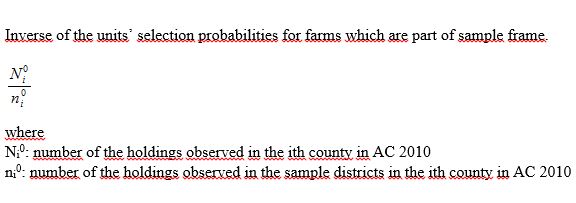
Small private holdings: 3 007 enumeration districts were selected from the enumeration districs of the AC 2010 (total 13 634). The selected enumeration areas contained 957 942 addresses. After applying the farm thresholds, 91 955 questionnaires were completed by enumerators, while 6 406 were sent via internet before the surveyors started their work on the field. After the imputation and the elimination of the ineligible holdings 97 571 records were sent to Eurostat.

Key private holdings: 3 119 holdings were selected, of which 2 697 filled the questionnaire. 2 949 records were sent to Eurostat.

Agricultural enterprises: 20 916 agricultural enterprises were selected of which 10 003 carried out agricultural activity. After the elimination of the ineligible holdings 8 724 records were sent to Eurostat.

Total number of holdings: 111 061 questionnaires were completed and 1 173 were imputed. After elimination of the ineligible holdings 109 244 records (plus 5 common land units) were sent to Eurostat. The final weighted population is 429 995 (5 common land units included).


4. The survey coverage of the records sent to Eurostat
The coverage of the records sent to Eurostat is different from the national survey coverage: holdings using only forest, fish-pond, reed area, fur animals other than rabbits and holdings providing only agricultural services are excluded from Eurofarm database.


5. The number of holdings in the population covered by the records transferred to Eurostat
Number of holdings 429 995 in the final weighted population (5 common land units included).


6. Holdings with standard output equal to zero included in the records sent to Eurostat
  • 1962 (sample) holdings with fallow land kept in good agricultural and environmental conditions;
  • 133 (sample) holdings with permanent grassland and meadow - no used for production, eligible for subsidies;
  • 52 (sample) holdings with ‘other livestock’ - rabbits except breeding rabbits;
  • 506 (sample) holdings with area of kitchen garden and that of forest, fish-pond and reeds.


7. Proofs that the requirements stipulated in art. 3.2 the Regulation 1166/2008 are met in the data transmitted to Eurostat
As the survey uses a threshold of utilised agricultural area less than 1 hectare, art 3.2 is not applicable.


8. Proofs that the requirements stipulated in art. 3.3 the Regulation 1166/2008 are met in the data transmitted to Eurostat
Due to the correspondence between the thresholds of the Regulation and the Hungarian criteria, there is no chance to fail to meet the requirements.
2.7. Reference area
Location of the holding. The criteria used to determine the NUTS3 region of the holding
In case of regular holdings (109 244) the residence of the farmer is considered as the location of the holding.

In case of common land units (5) the administrative centre of NUTS3 region is used.

2.8. Coverage - Time
Reference periods/dates of all main groups of characteristics (both included in the EU Regulation 1166/2008 and surveyed only for national purposes)
The reference periods/dates of the main groups of national characteristics of the Regulation 1166/2008 are respected as follows:

1 June 2016 for land characteristics (including the changes of land area between 1 June 2015 and 31 May 2016),

1 June 2016 for livestock characteristics,

a period of 12 month ending 31 May 2016 for labour force and production methods characteristics,

a period of 3 years (2014-2016) for rural development measures.
2.9. Base period

[Not requested]


3. Statistical processing Top
1.Survey process and timetable
See Annex 3.FSS 2016 Survey processing, timetable, the bodies involved and the share of responsibilities among bodies


2. The bodies involved and the share of responsibilities among bodies
See Annex 3.FSS 2016 Survey processing, timetable, the bodies involved and the share of responsibilities among bodies


3. Serious deviations from the established timetable (if any)
No serious deviation from the established calendar.


Annexes:
3.FSS 2016 Survey processing, timetable, the bodies involved and the share of responsibilities among bodies
3.1. Source data
1. Source of data
Agricultural enterprises: full scope survey

Small private holdings: sample survey

Key private holdings: full scope survey

Administrative sources:

  • Organic farming
  • IACS
  • Vineyard register


2. (Sampling) frame
Types of frames:
  • Agricultural enterprises: list frame
  • Key private holdings: list frame
  • Small private holdings: combination of area and list frame

Agricultural enterprises:
The source of the frame is the Business Register of HCSO containing legal entities engaged in any kind of agricultural activity regardless of its size. Agricultural enterprises operating in 2016 constituted the frame. Additional enterprises were added based on administrative records (data of farmers receiving subsidy, organic farming register). Updated continuously with data transmitted from the Registry Court.

Private holdings:
The sources of the frame are:

  • enumeration areas of AC 2010;
  • Farm Register of private holdings;
    Updated exhaustively when an agricultural census is carried out (latest one was in 2010). After the agricultural census 2010 the Farm Register was updated only partially based on the information of FSS (2013) and regular sample surveys. In the preparation phase of FSS 2016 the register was updated with information from the following administrative sources:
    • farmers receiving area based subsidies (from IACS);
    • farmers involved in organic farming (from Organic Farming Register);
    • licensed traditional small-scale producers (they are private persons involved in agricultural activities listed in the relevant law on his/her own farm and hold a registered licence for the activity and fall under special tax rules).


3. Sampling design
3.1 The sampling design
Agricultural enterprises and key private holdings – full scope, no sampling; (Small) private holdings (apart from key private holdings) – stratified one-stage cluster sampling (probability design), where the stratification means geographical stratification (counties) and the clusters are survey districts.
Districts were selected with simple random sampling within counties and within each district all the farms are included (including new farms as well).
The selection rate of districts was different county by county. 
The extrapolation factors were calculated at county level.
3.2 The stratification variables
(Small) private holdings – county (NUTS3)
3.3 The full coverage strata
Agricultural enterprises and key private holdings – full scope
3.4 The method for the determination of the overall sample size
(Small) private holdings 

The next process was followed for the determination of the overall sample size. At first step the sample for private farms was considered as stratified sample, where the sampling units were survey districts and stratification meant geographical stratification. Summarized information about private farms was used at this step − in survey district level − based on the results of AC2010. All necessary input for the determination of the overall sample size (sum, average, variance) were calculated in this way.

In the second step was checked whether the sample is good enough as a cluster sample and satisfies the precision requirements. More than 100 sample selection and calculation of the RSEs for involved variables (based on the results of AC2010) were done considering our sample as a cluster sample.

Sample size is a number of survey districts (and not the number of holdings).
The sample contains 3 007 enumeration areas (districts).

3.5 The method for the allocation of the overall sample size
(Small) private holdings

Overall sample size were allocated amongs counties by a Neyman allocation, using the number of holdings for calculating the standard deviation.

Minimum sampling rate (at least 10% for each county) also was considered during the allocation.
3.6 Sampling across time
(Small) private holdings - New sample is drawn for each occasion
3.7 The software tool used in the sample selection
(Small) private holdings - Oracle/SQL/Excel
3.8 Other relevant information, if any
Not available


4. Use of administrative data sources
4.1 Name, time reference and updating
Organic Farming Register
  • Legal base: Commission Regulation (EC) 889/2008;
  • Time reference: 2016
  • Updating of the source: continuously

Integrated Administrative and Control System (IACS)

  • Legal base:  Council Regulation (EEC) 1782/2003               
  • Time reference: 2016
  • Updating of the source: continuously

Vineyard Register

  • Legal base:  Council Regulation (EEC) 479/2008; Council Regulation (EEC) 436/2009
  • Time reference: 2016
  • Updating of the source: continuously

Uniform Animal Registration and Identification System

  • Legal base: Ministerial Regulation (MARD) No 99/2002. (15. XI.) 
  • Time reference: 2016
  • Updating of the source: continuously
4.2 Organisational setting on the use of administrative sources
The number of administrative data sources and other secondary data sources used for the production of official statistics has increased in the HCSO in the past few years. Data transmissions were managed differently throughout the HCSO with different security, metadata and database management. In order to address this issue, a new, integrated data transmission system, called KARAT was developed in 2013-2014 for the transmission of secondary data to the HCSO from their data providers.  In case of FSS 2016 part of the administrative data was transmitted to HCSO within the KARAT system, while others were provided to HCSO on the basis of an official inquiry addressed to the given organization.
4.3 The purpose of the use of administrative sources - link to the file
Please access the information in the file at the link: (link available as soon as possible)


4.4 Quality assessment of the administrative sources
  Method  Shortcoming detected Measure taken
- coherence of the reporting unit (holding)  

IACS and Organic Farming Register:

Beneficiaries in IACS, in Organic Register and FSS holdings are not identical.

IACS and Organic Farming Register:

IACS and organic production identifiers were collected on questionnaires. When several beneficiaries belong to one holding, aggregated administrative data were matched based on the collected identifiers. 

Name and address were used in case of the private holdings where identifiers were not available. In this case some manual work was needed.
- coherence of definitions of characteristics  


Vineyard Register: 
In the FSS, land area data are collected on vineyards according to the main use (for wine, table, other).  It is not possible to provide individual distribution of the quality vine area of the register.
Vineyard Register - Quality wine area:  In order to split the quality wine grapes the following method was used:
  1. the land area of quality and other wines by wine communities have been received from the National Council of Wine Communities (NCWC), from which a ratio among them was calculated on the lowest available level,
  2. the list of municipalities for each wine community is available,
  3. the holdings cultivating vineyards were linked to the regarding wine community using the names (codes) of the settlements,
  4. the vineyard area of each farmer in the regarding wine community was split among the quality and other wine categories according to the calculated ratio,
  5. the vineyards outside the wine communities are considered as other wines, because legally quality wines are not to be produced on areas outside the wine communities.
- comparability   Organic Farming Register:
The reference period of the organic farming register is different from the reference period of the farm structure survey, because the control and registration of organic farming is taking place in the period from spring till autumn of the year concerned.
Organic Farming Register:
The different reference periods were taken into consideration during processing of the data. Only the crops that were recorded at the time of the FSS data collection were reported as organic.
- coverage   Not found  
   over-coverage      
   under-coverage      
   misclassification      
   multiple listings      
- missing data   Not found  
- errors in data   Not found  
- processing errors   Not found  
- comparability   Not found  
- other (if any)   Not found  


4.5 Management of metadata
Data of administrative sources (Organic Farming Register, Integrated Administrative and Control System (IACS), Vineyard Register, Uniform Animal Registration and Identification System (ENAR)) are suitable for statistical use, however HCSO do not store the metadata of these databases. Organic farming data provided to HCSO via email, IACS data by using share point, Vine Register and ENAR data through the KARAT system. Data are updated regularly by the owners of of administrative sources. The data are stored and maintained in electronic format.
4.6 Reporting units and matching procedures
Organic Farming Register – agricultural holding

The link between the organic farm register and the holdings surveyed is created by the following way:

  • Matching statistical ID code in case of the agricultural enterprises;
  • Matching IACS identifiers. Some respondents did not provide this data in FSS 2016 questionnaire;
  • Matching organic producer ID code. Some respondents did not provide this data in FSS 2016 questionnaire;

Integrated Administrative and Control System (IACS) – agricultural holding

  • Matching statistical ID code in case of the agricultural enterprises;
  • Matching IACS identifiers. Some respondents did not provide this data in FSS 2016 questionnaire;

Vineyard Register – agricultural holding

Uniform Animal Registration and Identification System – agricultural holding

Matching name and address in case of the private holdings where IACS identifiers and organic producer ID codes were not available: in this case some manual work was needed.

4.7 Difficulties using additional administrative sources not currently used
No difficulties.
3.2. Frequency of data collection
Frequency of data collection
According to the Regulation (EC) No 1166/2008.
3.3. Data collection
1. Data collection modes
  • ELEKTRA (self-filling application)

From 2013 agricultural enterprises report their agricultural activity electronically within the ELEKTRA (https://elektra.ksh.hu/) system which is a legal requirement in Hungary.

Key private holdings were directed to the ELEKTRA system after closing the self-filling period. (They had the possibility to fill in their questionnaire during the self-filling period.)

  • E-MEZO (self-filling application)

It is a web application accessible by internet which enables filling in the questionnaires electronically by data providers. The application includes controls within and between tables.

Certain part of private holdings (farms receiving subsidy, certified organic farms and licenced small-scale producers), together almost 51 thousand holdings and 3 thousand key private holdings could fill in the questionnaire electronically by using this method during the self-filling period. They were informed in a postal letter about their login code and password in the middle of May. By the end 15.1 per cent of these private holdings provided data with this mode.

  • CAPI (Computer Assisted Personal Interwiev)

It is a web-based application which can be used both on line and off line modes and makes possible filling in the questionnaire by enumerators with mobile devices.

The questionnaires generated in the self-filling application and CAPI modules are stored in a central database. It contains the same controls as the E-MEZO self-filling application.

The system contains a Monitoring which is a web-based application that allows to maintain the pre-loaded address list, monitoring the field work.


2. Data entry modes
Not applicable.


3. Measures taken to increase response rates
Communication campaign: The communication campaign implemented before and during the survey execution provided the most important information about FSS 2016 to the farmers. The importance of FSS 2016 at national level and the benefits that farmers could gain were emphasized.

The communication campaign included the following elements:

  • posters informing about the survey were placed in towns and villages;
  • brochure by counties were produced including the most important information about FSS 2016, international and county specific data;
  • press conferences: one held in the HCSO in Budapest and nine in different towns;
  • announcements about the implementation of FSS 2016 were published in the nation-wide and local media, including official Facebook page of HCSO;
  • articles and interviews relating to the implementation as well as the main features of the survey were published.

Call Centre: A Call Centre was operated between 10 May 2016 and 15 July 2016. Respondent could ask questions by using free telephone line. In total 3628 calls were received, 67 per cent during the internet self-filling period. Questions related to IT problems were answered by the staff of HCSO IT Services Department. 200 emails were received from the respondents in the self-filling period which were answered by the staff of AESD.

Private holdings

  • The surveyors and supervisors were trained how to handle difficult respondents. The survey supervisors with the help of the local authorities managed to convince nearly all the non-respondents, thus legal steps were not taken.
  • When holders could not be contacted, the enumerator left a note to inform the holder about the time of his/her next visit.

Agricultural enterprises

  • Automatic reminders were sent via email to the enterprises (just before and after the deadline) that did not send the questionnaire back by due time.
  • In ambiguous cases the missing data were fixed by the colleagues of the Regional Departments, by contacting the enterprises concerned.
  • Legal steps were not taken.


4. Monitoring of response and non-response*
1 Number of holdings in the survey frame plus possible (new) holdings added afterwards

In case of a census 1=3+4+5

cca. 440 000
2 Number of holdings in the gross sample plus possible (new) holdings added to the sample

Only for sample survey, in which case 2=3+4+5

  188 726
3 Number of ineligible holdings   76 855
3.1 Number of ineligible holdings with ceased activities

This item is a subset of 3.

 20 629
4 Number of holdings with unknown eligibility status

4>4.1+4.2

 1 330
4.1 Number of holdings with unknown eligibility status – re-weighted
4.2 Number of holdings with unknown eligibility status – imputed
5 Number of eligible holdings

5=5.1+5.2

 110 541
5.1 Number of eligible non-responding holdings

5.1>=5.1.1+5.1.2

 2470
5.1.1 Number of eligible non-responding holdings – re-weighted  0
5.1.2 Number of eligible non-responding holdings – imputed  1 173
5.2 Number of eligible responding holdings  108 071
6 Number of the records in the dataset 

6=5.2+5.1.2+4.2

109 244

 * 5 common land units excluded.

5. Questionnaire(s) - in annex
See annexes.


Annexes:
3.3-5. FSS 2016 Questionnaire of private holdings
3.3-5. FSS 2016 Questionnaire of agricultural enterprises
3.3-5. FSS 2016 Field work check list
3.4. Data validation
Data validation
On-line checks:

FSS 2016 was carried out electronically in case of all holdings in Hungary. The advantage of the electronic data collection was that logical and arithmetical coherence checks within and between the tables were incorporated into E-MEZO (both the self-filling and the CAPI application) and ELEKTRA. They were the following:

  • Completeness checks (e.g. registration of arrived questionnaire, causes of non-response);
  • Completeness checks within the questionnaires (e.g. all identification information and compulsory information);
  • Data format checks (ha, m2; use of decimals);
  • Data value checks (e.g. number of working days cannot exceed 365);
  • Logical and arithmetical coherence within and between the tables (e.g. coherence between arable land and irrigation);
  • Routing (skip) checks (e.g. in case of no land use skip to the next question);
  • Plausibility checks (e.g. current value must be within a plausible range from value in administrative data sources)  
  • Questionnaire could be sent after all errors corrected.

Batch-checks:

Errorless questionnaires were stored in an ORACLE form data base. Batch checks (arithmetical and logical) were run within ADÉL (Uniform Data Entry and Validation System) of HCSO including the same checks as the above mentioned applications. The application could produce error lists, aggregated data per tables per counties etc.
3.5. Data compilation
Methodology for determination of weights (extrapolation factors)
1. Design weights


2. Adjustment of weights for non-response
Not applied
3. Adjustment of weights to external data sources
No
4. Any other applied adjustment of weights
No
3.6. Adjustment

[Not requested]


4. Quality management Top
4.1. Quality assurance

[Not requested]

4.2. Quality management - assessment

[Not requested]


5. Relevance Top
5.1. Relevance - User Needs
Main groups of characteristics surveyed only for national purposes 
 
Main group National characteristics surveyed Users
Land use Renting prices and land area by location HCSO for EAA, government organisations, private users
More detailed breakdown of fruits by species Agricultural government organisations, research institutions and universities
Livestock production More detailed observation of livestock Agricultural government organisations, research institutions and universities
Change in livestock HCSO for the production of livestock supply balance sheets and for EAA
Amount, value and sale price of animals sold for further keeping HCSO for EAA
Labour force Agricultural qualification of each person belonging to the holding HCSO to ensure comparability with previous data
Production methods More detailed, not only percentage bands and yes/no questions asked. Nitrate and greenhouse gas reporting Government organisations
Other Agricultural services provided HCSO for EAA
5.2. Relevance - User Satisfaction

[Not requested]

5.3. Completeness
Non-existent (NE) and non-significant (NS) characteristics - link to the file. Characteristics possibly not collected for other reasons
Please find the information in the file at the link: (link available as soon as possible)
5.3.1. Data completeness - rate

[Not requested]


6. Accuracy and reliability Top
6.1. Accuracy - overall
Main sources of error
Sampling error
In case of private holdings a sample survey was carried out, thus sampling error occured. The relative standard errors for almost all main characteristics fulfilled the precision requirements.  

Non-sampling error
During the survey and validation process the effects of non-sampling errors were reduced as much as possible. Therefore the importance of non-sampling error – apart from non-response error – was negligible. There was no significant step taken because of this reason. Non-response error was corrected by imputation.

6.2. Sampling error
Method used for estimation of relative standard errors (RSEs)
Formulae applied for estimation methods are provided in the annex.


Annexes:
6.2. Estimation methods and errors
6.2.1. Sampling error - indicators

1. Relative standard errors (RSEs) - in annex


2. Reasons for possible cases where precision requirements are applicable and estimated RSEs are above the thresholds
The RSE’s are under 5% limit for almost all considered characteristics. But the expected threshold in case of area of plants harvested green in HU10 was missed. According to the preliminary results of the designed sample the variance of the above mentioned characteristic was below the limit. The calculated RSE based on the collected data was slightly higher than expected.


Annexes:
6.2.1-2. FSS 2016 Relative standard errors
6.3. Non-sampling error

See below

6.3.1. Coverage error
1. Under-coverage errors
A separated stratum for the private holdings having significant agricultural activity (key private holdings) was created, and some holdings were reclassified from the private holdings to key farms after the survey only in the sampled area. They are handled as being observed exhaustively (without extrapolation factor). Undercoverage have been reduced by use of administrative sources for reclassification as many cases as possible before the survey, in order to reduce the number of such cases.


2. Over-coverage errors
Units which do not belong to the target population were not measured or were excluded during processing, so no over-coverage error occured.
2.1 Multiple listings 
Not significant, but they were handled by the surveyors during the survey. The design weights were not modified.


3. Misclassification errors
The center of the holding (address) and the major activity of the holding could be in different enumeration areas. Their allocation to strata was not changed.


4. Contact errors
In those cases when the contact was not successfull imputation was made (see 6.3.4. Processing errors - item 1.)


5. Other relevant information, if any
Not available.
6.3.1.1. Over-coverage - rate
Over-coverage - rate
40,7%
6.3.1.2. Common units - proportion

[Not requested]

6.3.2. Measurement error
Characteristics that caused high measurement errors
Some data providers (especially older people) can use non-SI measurement unit, e. g. acres for agricultural area, and give some information in this way. In those cases, the enumerator could collect data in non-SI-unit, and the program convert them to SI-unit. In case of outliers and suspicious cases follow-up interviews were carried out in order to check, correct or confirm the data.
6.3.3. Non response error
1. Unit non-response: reasons, analysis and treatment
In many cases agricultural enterprises did not answer the questionnaire, they registered as agricultural producers in Registry Court but do not carry out any agricultural activity in fact. In some cases contact was not successfull or response was refused.
Imputation was done in cases when other information about the holding were available (from administrative source or later survey).


2. Item non-response: characteristics, reasons and treatment
Because the data collection was done via internet or face to face interview with electronic device (tablet, laptop) validation rules were run during field work. The program did not allow to save the questionnaries with missing required items, therefore nonresponse item inside the filled part of questionnaries did not occur.

Mandatory items only could be missed when the entire groups of questions were lost.

To prevent these cases admistrative data was used for checking inside the program in those cases where this was possible.

Based on regular survey carried out in December corrections were done in some cases in the FSS database.
6.3.3.1. Unit non-response - rate
Unit non-response - rate
Agricultural enterprises: 13.7 %

Private holdings: 2.4 %

Total: 3.4 %
6.3.3.2. Item non-response - rate
Item non-response - rate
Negligible
6.3.4. Processing error
1. Imputation methods
1173 holdings were imputed based on the information of IACS or regular survey (in December 2016) or Organic farming register.
Missing records were imputed based on selected similar records (donor imputation).
In those cases when information about the farm was available in the regular survey carried out in December, the most similar holding was selected for each missing one. Euclidean distance was calculated based on selected most important variables weighted with their SO coefficients, to look for the donor holdings. In those cases when information about the farm in IACS or Organic farming register was available the similar method was followed, using the available variables.


2. Other sources of processing errors
The validation rules were sometimes interpreted wrongly so the algorithms were erroneous. Wrong algorithms and errors in implementation were identified and corrected.


3. Tools used and people/organisations authorised to make corrections
Although data entry is not a separate task owing to the newly developed E-MEZO system, the former ADÉL was still necessary to ensure the consistency of data even after corrections in the data base.

All the data entry applications were developed by the IT Department in the framework of uniform Data Entry and Validation System run by the Central Statistical Office. As many validation rules as possible were incorporated to the data entry application such as logical and arithmetical coherence within and between tables, both in case of electronic and traditional data entry.

Four categories of error levels were handled during data entry phase as follows: (1) less serious errors only for information; (2) errors can be accepted, but justification is needed; (3) only authorized survey administrators can accept serious errors; (4) unacceptable errors must be corrected immediately, the data entry only can be carried on after correction.

Data on the number of corrections were not collected during data processing. Control was carried out during the survey period by supervisors, area agents and local staff of HCSO while in data processing period by local and central staff of HCSO.
6.3.4.1. Imputation - rate
Imputation - rate
Agricultural enterprises: 5.1 %

Private holdings: 0,1 %

Total: 1.1 %
6.3.5. Model assumption error

[Not requested]

6.4. Seasonal adjustment

[Not requested]

6.5. Data revision - policy
Data revision - policy
No data revision policy was applied in case of FSS.
6.6. Data revision - practice
Data revision - practice
Not applicable
6.6.1. Data revision - average size

[Not requested]


7. Timeliness and punctuality Top
7.1. Timeliness

See below

7.1.1. Time lag - first result
Time lag - first result
Time lag first results: June 2016 +5 months
7.1.2. Time lag - final result
Time lag - final result
Time lag final results: June 2016+18 months; December 2016 + 12 months.
7.2. Punctuality

See below

7.2.1. Punctuality - delivery and publication
Punctuality - delivery and publication
First result: t+0

Final results: t+0


8. Coherence and comparability Top
8.1. Comparability - geographical
1. National vs. EU definition of the agricultural holding
The definition of agricultural holding in Hungary covers also holdings with only forest, fish ponds, reeds, fur animals other than rabbits and holdings providing only agricultural services and agricultural enterprises registered as agricultural producers in Registry Court but without carrying out any agricultural activities.


2.National survey coverage vs. coverage of the records sent to Eurostat
The coverage of the records sent to Eurostat is different from the national survey coverage: holdings using only forest, fish-pond, reed area, fur animals other than rabbits and holdings providing agricultural services only are excluded from Eurofarm database.


3. National vs. EU characteristics
Handbook on implementing the FSS and SAPM definitions - REV 10 was used for the organisation of the current FSS survey.

The number of hours/year for a full-time employee to calculate AWU: 8 hours/day; 225 days/year; 1800 hours/year.


4. Common land
4.1 Current methodology for collecting information on the common land
There are two options to define the whole area of common land in Hungary. Questions can be directed to the owners and providers or to the users of common land. In order to avoid duplications, the focus has been moved to the owners. However, the users were also asked about their type of tenure, which makes easier the distribution of common land amongst their users.

The Hungarian legislation identifies precisely the land utilisation types and the users. Common land utilisation is not a legally existing form. Furthermore, for the eligibility for single area payment schemes aid, land use rights should be verified.

All of the local governments were involved (some 3 thousand data providers, but municipalities not carrying out any agricultural activity can have an exemption) in data collection for agricultural enterprises in the framework of the FSS2016 survey. Due to the fact, that the owner of a common land is a public entity, data providers could be limited to the group of agricultural enterprises and thus included in this survey.

During the survey, the following criteria were taken into account:

  • only municipal grasslands are considered as common land;
  • land is used by more than one holding simultaneously;
  • common grassland is not divided, there is no territorial restriction for farmers;
  • there can be an oral or written agreement, but it is not a must;
  • utilisation is free of charge.
Common land area is recorded in a special unit in the dataset for each NUTS3 region (where observed, altogether 5 units), and is considered as common land units.
4.2 Possible problems encountered in relation to the collection of information on common land and possible solutions for future FSS surveys
Common land is not a widespread phenomenon in public awareness as it is not included in annual data collections. Common land can only exist in case of municipalities. Unfortunately, administrators by these local offices have usually no agricultural qualification and written instructions in the guideline are not enough for the proper filling in. In some cases, land owned and used by the local government is recorded as common land which need a follow-up and correction. They are confused about common land and mix up the concepts of undivided property ownership and courtesy of land use with it.
4.3 Total area of common land in the reference year
The total area of common land relates to permanent grassland and meadow - rough grazing. In Hungary this kind of land use counts 288 hectares.
4.4 Number of agricultural holdings making use of the common land or Number of (especially created) common land holdings in the reference year
No information is available on the number of agricultural holdings making use of common land. 5 common land units were created (one for each concerned NUTS 3 region). These holdings aggregate all of the areas considering grassland and meadow (rough grazing) in Hungary county by county, which are used not exclusively by one holding only.


5. Differences across regions within the country
No


6. Organic farming. Possible differences between national standards and rules for certification of organic products and the ones set out in Council Regulation No.834/2007
There are no differences between the register definitions and Eurofarm definitions.
8.1.1. Asymmetry for mirror flow statistics - coefficient

[Not requested]

8.2. Comparability - over time
1. Possible changes of the definition of the agricultural holding
There have been no changes.


2. Possible changes in the coverage of holdings for which records are sent to Eurostat
Respondents with at least 500 m2 nurseries and other permanent crop area  (B_4_5+B_4_6) are considered as agricultural holdings in 2016 compared to 2013. The change has no significant impact (only 1 plus record).


3. Changes of definitions and/or reference time and/or measurements of characteristics
For rural development a period of 3 years (2014-2016) applied.   


4. Changes over time in the results as compared to previous FSS, which may be attributed to sampling variability
The sample is not representative for organic characteristics.


5. Common land
5.1 Possible changes in the decision or in the methodology to collect common land
No changes in the decision and in the methodology.
5.2 Change of the total area of common land and of the number of agricultural holdings making use of the common land / number of common land holdings
Comments on major trends from FSS 2013 to FSS 2016*
  FSS 2013 FSS 2016 2016/2013 Difference,%  
Common land area, ha 67 228 288 0,43% -99,57%

*The figures used in the table as common land refer to only permanent grassland and meadow - rough grazing.

The significant change of common land area from 2013 to 2016 can be explained by the followings:

  • The measurement unit (hectare) was not understood by the respondents in 2013.
  • The definition of common land was misunderstood by the holdings in 2013 as the results contained both owner and tenant farming compared to 2016 when the area used was registered.
  • The methodology differs in some aspects, mainly in questioning. In 2016, common land was incorporated into the FSS questionnaire but only for grassland, in 2013 common land area was collected by all land use categories.


6. Major trends on the main characteristics compared with the previous FSS survey*
Main characteristic Current FSS survey Previous FSS survey Difference in % Comments
Number of holdings 429 990   486 741 -11,7%  Decreased due to concentration of holdings
Utilised agricultural area (ha) 4 670 267  4 589 292 1,8%   
Arable land (ha) 3 821 827  3 800 822  0,6%   
Cereals (ha) 2 282 508  2 437 585  -6,4%   
Industrial plants (ha) 905 531  796 322  13,7%  In parallel with the decrease in the area of cereals (due to the oversupply resulting from copious harvests in the past few years and lower expected sales prices) more and more industrial plant were sown. With its favourable crop prices sunflower is more and more popular among farmers while rape approximated again the value of 2010.
Plants harvested green (ha) 344 117  306 490  12,3%  The sown area of alfalfa – which, as a nitrogen-fixing crop, is one of the possible ways of greening – grew substantially. As another greening action, the area of temporary grasslands increased significantly as well.
Fallow land (ha) 140 726  131 609 6,9%   
Permanent grassland (ha) 689 704  635 489 8,5%   
Permanent crops (ha) 150 265  138 609 8,4%   
Livestock units (LSU) 2 444 888  2 259 077 8,2%   
Cattle (heads) 847 524  755 087 12,2%  Subsidy related to cow and meat cattle has been increasing since 2013.
Sheep (heads) 1 213 522  1 149 807 5,5%   
Goats (heads) 100 207  89 045  12,5% Subsidy related to nanny goats has been increasing since 2013.
Pigs (heads) 2 978 842  2 865 910  3,9%   
Poultry (heads) 46 691 970  41 099 950  13,6%  The increase of poultry stock is continuous from 2013 in case of agricultural enterprises.
Family labour force (persons) 702 953 957 576 -26,6%  The concentration of private holdings continued even after 2013. Not only the holders and family members of the 56 thousand small holdings which ceased their activity but also many family members of the still existing small, mainly semi-subsistence farms gave up agricultural activity. 
Family labour force (AWU) 257 974  313 987 -17,8% 
Non family labour force regularly employed (persons) 111 458  92 245  20,8%  In case of bigger (market oriented) holdings family labour force is increasingly replaced by the more efficient paid workers. This process is reflected both in the increase of the number and the AWU of regularly employed labour force. 
Non family labour force regularly employed (AWU) 96 574  81 122 19,0% 

*Without common land units.

8.2.1. Length of comparable time series

[Not requested]

8.3. Coherence - cross domain
1. Coherence at micro level with other data collections
Data were compared at micro level with data of IACS and Uniform Animal Registration and Identification System. The differences were found acceptable.


2. Coherence at macro level with other data collections
Data were compared with the results of the AC 2010, FSS 2013 and other annual statistical surveys such as crop and livestock surveys. The results met the expectations. 

The FSS 2016 results have proved to be of good quality, however, the aggregates of different land areas cover only the area that can be connected to the agricultural holdings. (At the same time the current statistics cover the land area unidentifiable with holdings as well, which means that the published aggregates contain and reflect additional expert estimations.)

FSS data of agricultural organisations can be combined with other data or statistical domains.
8.4. Coherence - sub annual and annual statistics

[Not requested]

8.5. Coherence - National Accounts

[Not requested]

8.6. Coherence - internal

[Not requested]


9. Accessibility and clarity Top
9.1. Dissemination format - News release

[Not requested]

9.2. Dissemination format - Publications
1. The nature of publications
Title of publication Internet Content
Agriculture in Hungary, 2016, preliminary data X Number of holdings; Type of farming and purpose of production; Land use; Livestock; Farm labour force; NUTS 2 level.
Data compilation, final data X Data compared to FSS 2010 and 2013; Summary data; SO values; Type and aim of production; Agricultural area; Arable land area; Vineyard and orchard area; Livestock; Agricultural labour; Agricultural production methods; Other gainful activities; NUTS 2 level.
Regional differences in the Hungarian Agriculture, 2016, final data X The publication presents the final results of the Farm Structure Survey 2016. It gives detailed information on the structure and main characteristics of the agricultural enterprises and private holdings. Regional differences are presented on maps; NUTS 3 level.


2. Date of issuing (actual or planned)
Title of publication Publication date (actual, planned)
Agriculture in Hungary, 2016, preliminary data 22 November 1016
Data compilation, final data 7 November 2017
Regional differences in the Hungarian Agriculture, 2016, final data December 2017


3. References for on-line publications
Agriculture in Hungary, 2016, preliminary data

http://www.ksh.hu/docs/hun/xftp/idoszaki/gszo/agrariumelo16.pdf

Data compilation

http://www.ksh.hu/agrarcenzusok_agrarium_2016_tablak

Regional differences in the Hungarian Agriculture, 2016, final data

http://www.ksh.hu/agrarcenzusok_agrarium_2016
9.3. Dissemination format - online database
Dissemination format - online database
http://www.ksh.hu/agrarcenzusok_gszo
http://statinfo.ksh.hu/Statinfo/themeSelector.jsp?page=2&szst=OMC
9.3.1. Data tables - consultations
Data tables - consultations
Agrárium 2016, preliminary data 2016 2017
1-st quarter 2017 432 -
2 nd quarter 2017 - 711
3-rd quarter - 531
July-August 2017 - 148 
9.4. Dissemination format - microdata access
Dissemination format - microdata access
As regards to access to microdata for scientific purposes, researchers may have access to data through six channels upon filling in the request form published on the HCSO’s website. The six data access channels are: release of tabular data, public use files, release of anonymised microdata sets, Safe Centre, remote access and remote execution. The first 2 channels are open to all users; the last four channels are available exclusively for scientific purposes.

Anonymised microdata may be accessed by research institutions within the framework of a contract with the HCSO. Anonymised microdata are microdata which have been modified in order to reduce to an acceptable level, in accordance with current best practice, the disclosure risk of statistical units to which they relate.

The researcher may only use the data file for the scientific research purpose indicated in the request form and the data file has to be destroyed upon fulfilment of that purpose. The detailed conditions for the use of anonymised microdata are regulated in the contract between the research institution and the HCSO.

Researchers may also have access to microdata in a secure environment such as the HCSO’s Safe Centre, another remote access point and through remote execution. The Farm Structure Surveys data of 2000, 2003, 2005, 2007, 2010, 2013 are already accessible and that of 2016 are planned to be made accessible for researchers.

The HCSO facility in Szeged is providing a remote access service to researchers under the same conditions as for the Safe Centre environment (available on HCSO premises in Budapest).

In the form of remote execution, researchers can also apply for research outputs based on microdata sets. Using this access channel, the researchers are requested to send detailed specifications and descriptions, syntax, etc. to HCSO and the data is prepared by HCSO experts within HCSO. Outputs produced are released following an obligatory output checking procedure (common procedure for Safe Centre, remote access and remote execution).

Data made available in the Safe Centre, remote access and remote execution does not contain direct identifiers. The access environment is strictly monitored and the research outputs are checked for statistical disclosure before they may be taken from the safe environment by the researcher.

The process of the evaluation of the data request for the safe environment data access channels covers checking information both on the research purpose and the researchers. Access is granted based on a contract which stipulates the conditions of access.

9.5. Dissemination format - other

[Not requested]

9.6. Documentation on methodology
1. Available documentation on methodology
http://www.ksh.hu/apps/meta.objektum?p_lang=EN&p_menu_id=430&p_almenu_id=101&p_ot_id=100&p_level=1&p_session_id=21051598&p_obj_id=OMC


2. Main scientific references
William G. Cochran (1977), Sampling Techniques, John Wiley & Sons
9.7. Quality management - documentation
Quality management - documentation
Not available.
9.7.1. Metadata completeness - rate

[Not requested]

9.7.2. Metadata - consultations

[Not requested]


10. Cost and Burden Top
Co-ordination with other surveys: burden on respondents
The regular survey on land area and sown area (May) as well as the survey on livestock (June) were not carried out in 2016 separately, questions related to those surveys were incorporated into the FSS 2016 questionnaire.


11. Confidentiality Top
11.1. Confidentiality - policy
Confidentiality - policy
The protection of personal data and the publicity of data of public interest are regulated by the following Acts in Hungary: 
  • Act CLV of 2016 on Official statistics;
  • Act CXII of 2011 on Informational Self-Determination and on Freedom of Information.

Besides the above mentioned legal acts, internal regulations on confidentiality exist within the HCSO. The access to statistical data is regulated in a separate internal regulation (Regulation 18/2014 on the rules of data access) which contains the rules on the six data access channels of the HCSO.

In virtue of the Act CXII of 2011 on Informational Self-Determination and on Freedom of Information and the Act XLVI CLV of 2016 on Official statistics all individual data are qualified as confidential and are treated as such. Survey data are validated and checked exclusively by the staff of HCSO and enumerators are responsible for preventing unauthorized access to the completed questionnaires.
11.2. Confidentiality - data treatment
Confidentiality - data treatment
In general, all data disseminated by HCSO goes through obligatory statistical disclosure control (SDC) procedures. The most commonly SDC method used for protecting sensitive cells is the cell suppression. Under the HCSO internal data protection regulation, all datasets are checked for secondary cell suppression where primary cell suppression is applied. Direct identifiers are removed from all datasets (except in cases regulated by law).

All research outputs produced in the safe environment (Safe Centre, remote access, remote execution) also go through obligatory output checking procedures.

Apart from these obligatory provisions, the typical SDC methods applied to FSS data are the following:

  • global recoding (removing a dimension (e.g. column)),
  • sub-sampling based on microdata,
  • local suppression.


12. Comment Top
1. Possible improvements in the future
Not available.


2. Other annexes
Not available.


Related metadata Top


Annexes Top