
Improving the territorial knowledge-base: Updated maps of land use and population for Europe
date: 18/01/2021
The LUISA team of the European Commission, JRC just finalised two key datasets for on-going and upcoming territorial assessments and policy support:
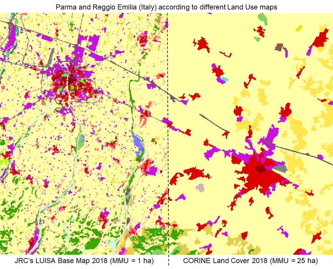
- The LUISA Base Map 2018: A detailed land use map constructed by integrating information from multiple data sources, including the CORINE Land Cover, Copernicus remote sensing products, TomTom and OpenStreetMap. The LUISA Base Map (available at 50 and 100 metre) has significantly higher spatial and thematic resolutions than CORINE, allowing more detailed assessments.
- The JRC-GEOSTAT 2018: A grid map reporting the number of residents for the year 2018 at 1 km resolution. This dataset, created in collaboration between JRC, REGIO and Eurostat, combines data on the number of residents at local level provided by the National Statistical Institutes and the density of built-up areas derived from Copernicus remote sensing products. For the majority of countries covered, the JRC-GEOSTAT 2018 is, by design, comparable to the GEOSTAT 2011.
Both datasets cover the EU27, EFTA countries, UK and the Western Balkans. Technical documentation describing both datasets in detail is under preparation. The datasets are currently available within the European Commission services upon request, and will be accessible to the public following the publication of the technical documentation.