
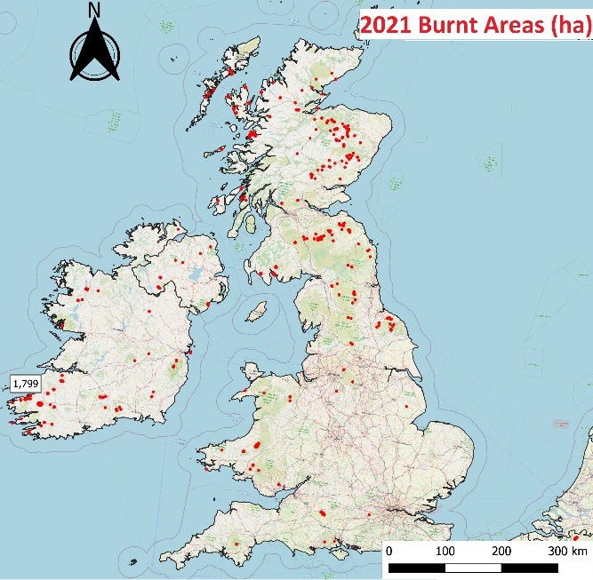
Half of the burnt area in Ireland in 2021 was in Muckross
The 2021 wildfire season was the second-worst in the European Union since 2000, when the European Forest Fire Information System (EFFIS) records began. Damages in 2021 were only surpassed by those in 2017, when over 1 million hectares (ha) burned in the EU. Of the total burnt area in 2021, half a million hectares, 20% occurred on ‘Natura 2000’ protected sites, in particular in Italy and Spain. The 2022 fire season started with a prolonged drought in southern Europe, and the resulting conditions have already caused numerous premature fire outbreaks.
The JRC provides a pivotal contribution to wildfire disaster risk reduction in Europe and globally through the development and operation of EFFIS. In August, a Pan-European wildfire risk assessment was published with the aim to conciliate previous approaches used by different countries, making a comparable assessment across countries and regions in Europe possible. This harmonised method will support the EU and its Member States protect lives and their natural environment by enhancing planning and coordination of prevention, preparedness and cross-border firefighting actions.