File:MAP GLD 2007.JPG
Size of this preview: 568 × 600 pixels. Other resolutions: 227 × 240 pixels | 2,349 × 2,481 pixels.
Original file (2,349 × 2,481 pixels, file size: 362 KB, MIME type: image/png)
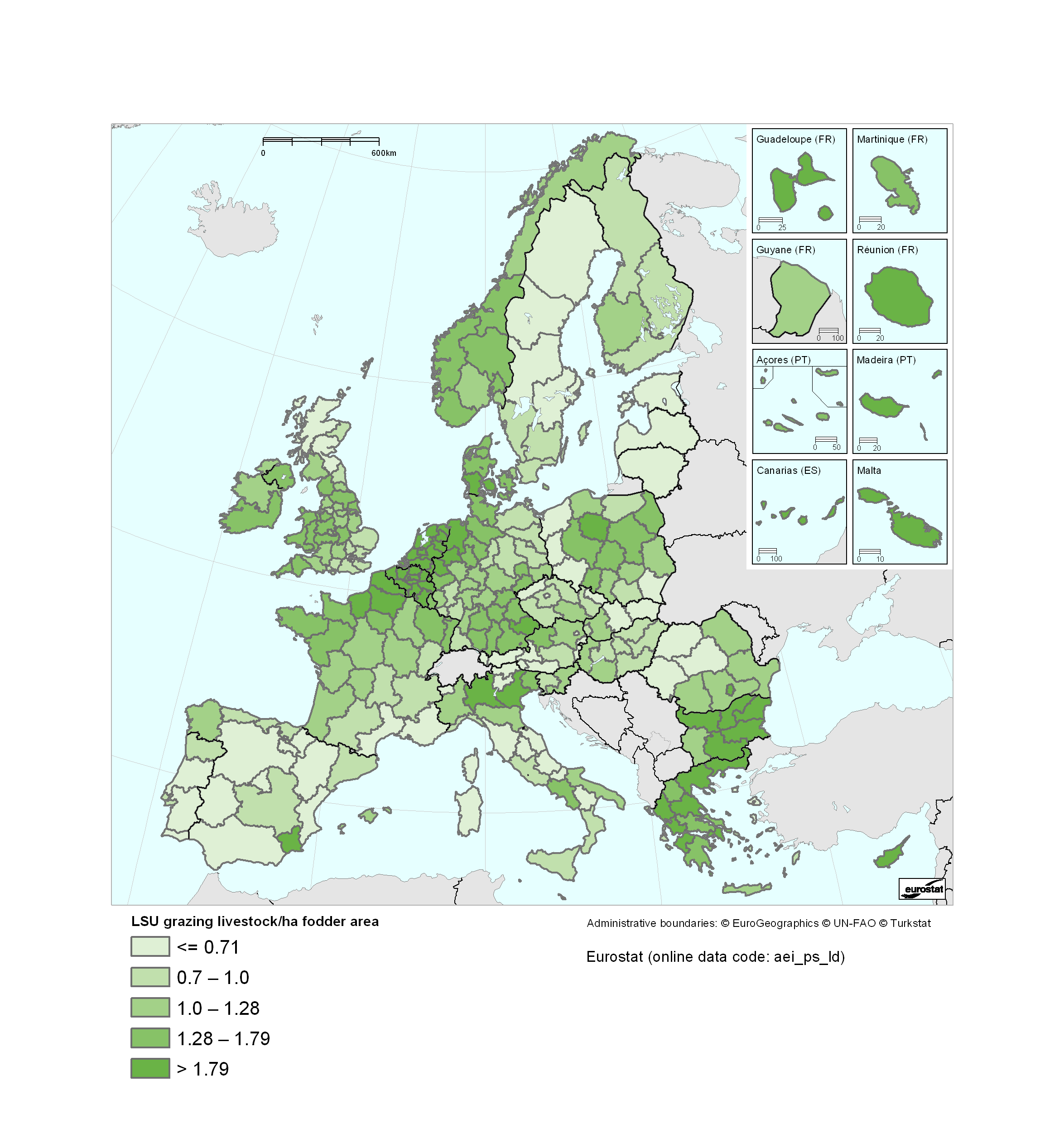
Grazing livestock density, EU27 and NO, NUTS2, 2007
Map created with data from 2007
Data extracted at 20/03/2012, most recent data available now, see:
File usage
There are no pages that use this file.