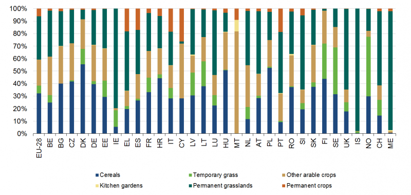
File:Cropping pattern – share of main land types in UAA, EU-28, IS, NO, CH, ME, 2010.png

Size of this preview: 800 × 379 pixels. Other resolutions: 320 × 152 pixels | 1,388 × 658 pixels.
Original file (1,388 × 658 pixels, file size: 23 KB, MIME type: image/png)
File usage
There are no pages that use this file.