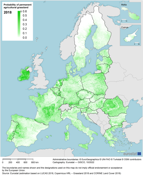
File:Map 1 - Probability of permanent agricultural grassland - 2018.png

Size of this preview: 491 × 599 pixels. Other resolutions: 197 × 240 pixels | 4,038 × 4,925 pixels.
Original file (4,038 × 4,925 pixels, file size: 3.74 MB, MIME type: image/png)
File usage
The following page uses this file: