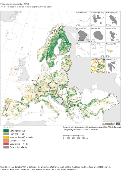
File:Forest connectivity, 2018 (% of forests in a fixed local neighbourhood area) RYB2022.png
Revision as of 10:57, 1 September 2022 by Nredpaaw (talk | contribs) (Nredpaaw uploaded a new version of File:Forest connectivity, 2018 (% of forests in a fixed local neighbourhood area) RYB2022.png)

Size of this preview: 423 × 599 pixels. Other resolutions: 169 × 240 pixels | 2,019 × 2,860 pixels.
Original file (2,019 × 2,860 pixels, file size: 653 KB, MIME type: image/png)
null
File usage
The following file is a duplicate of this file (more details):
There are no pages that use this file.