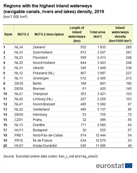
File:Regions with the highest inland waterways (navigable canals, rivers and lakes) density, 2019.PNG

Size of this preview: 476 × 599 pixels. Other resolutions: 191 × 240 pixels | 504 × 634 pixels.
Original file (504 × 634 pixels, file size: 33 KB, MIME type: image/png)
File usage
There are no pages that use this file.