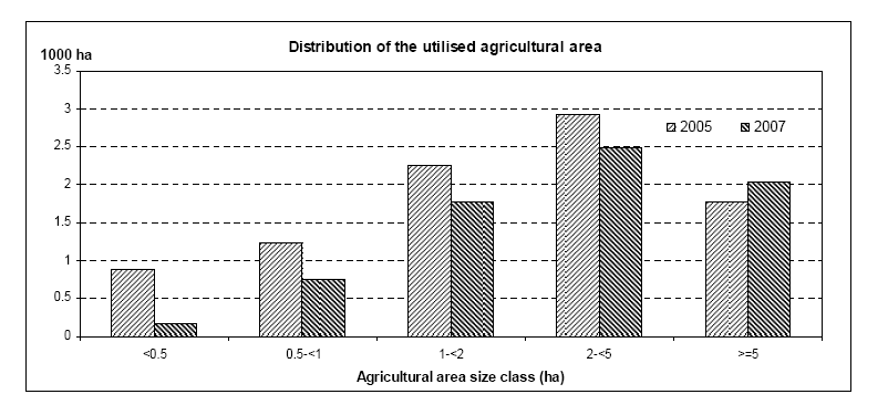
File:Distribution of the utilised agricultural area, Malta, 2007.PNG
Size of this preview: 800 × 374 pixels. Other resolutions: 320 × 150 pixels | 802 × 375 pixels.
Original file (802 × 375 pixels, file size: 55 KB, MIME type: image/png)
Distribution of the utilised agricultural area, Malta, 2007
Graph created with data from July 2008
File usage
The following page uses this file: