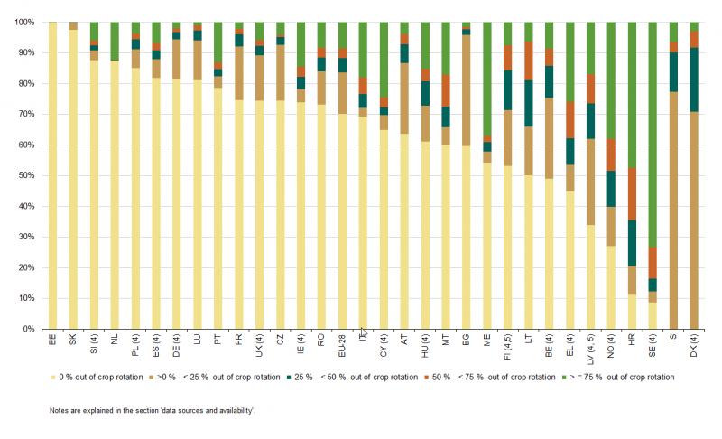
File:Share of arable area out of crop rotation, EU-28, IS, NO and ME, 2010.png
Revision as of 13:00, 8 October 2015 by Kukucmi (talk | contribs) (Kukucmi uploaded a new version of "File:Share of arable area out of crop rotation, EU-28, IS, NO and ME, 2010.png")

Size of this preview: 800 × 486 pixels. Other resolutions: 320 × 195 pixels | 1,306 × 794 pixels.
Original file (1,306 × 794 pixels, file size: 93 KB, MIME type: image/png)
File usage
There are no pages that use this file.