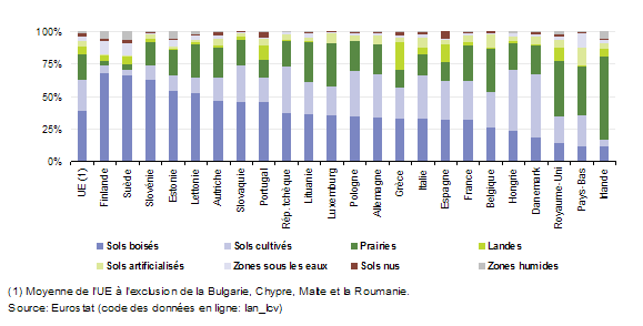
File:Main land cover by land cover type, 2009 (% of total area) YB2013-fr.png
Revision as of 14:15, 23 September 2013 by EXT-S-Allen (talk | contribs)
Main_land_cover_by_land_cover_type,_2009_(%_of_total_area)_YB2013-fr.png (579 × 294 pixels, file size: 10 KB, MIME type: image/png)
File usage
There are no pages that use this file.
