File:Structure of the agrarian landscape according to the degree of dominance of agricultural land use and its diversity in terms of number of crops, EU-27.png
No higher resolution available.
Structure_of_the_agrarian_landscape_according_to_the_degree_of_dominance_of_agricultural_land_use_and_its_diversity_in_terms_of_number_of_crops,_EU-27.png (681 × 411 pixels, file size: 10 KB, MIME type: image/png)
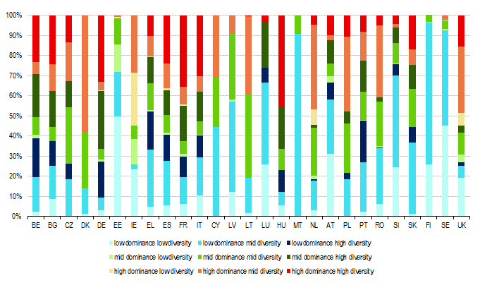
Structure of the agrarian landscape according to the degree of dominance of agricultural land use and its diversity in terms of number of crops, EU-27
Graph created with data from 1996 to 2005
Data extracted in October/2012.
File usage
The following page uses this file: