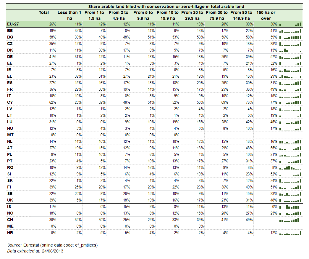
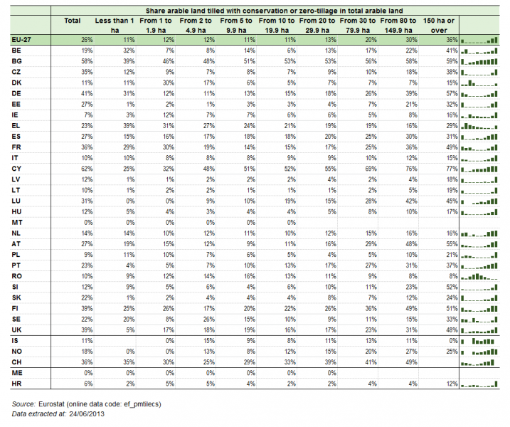
File:Share of conservation and zero-tillage of arable land under tillage by size of arable area, EU-27, 2010.png
Size of this preview: 717 × 600 pixels. Other resolutions: 287 × 240 pixels | 1,045 × 874 pixels.
Original file (1,045 × 874 pixels, file size: 39 KB, MIME type: image/png)
Title of figure, map or table, including last reference period
- Subtitle, if any
Figure Map Table created with data from Month Year
Most recent data available now, see:
code/default/table?lang=en title2_of_data_set (data code) code/default/table?lang=en title2_of_data_set (data code)
Delete below (and this line as well) before saving!
<a href="Category:Model">Image</a>
File usage
There are no pages that use this file.