File:LAUs, population and surface area affected by maritime service areas in EU coastal regions.PNG
No higher resolution available.
LAUs,_population_and_surface_area_affected_by_maritime_service_areas_in_EU_coastal_regions.PNG (796 × 529 pixels, file size: 32 KB, MIME type: image/png)
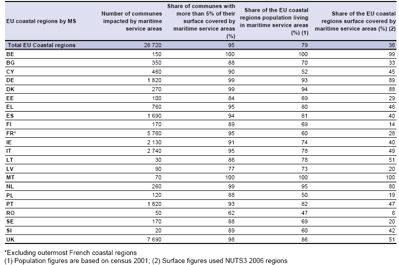
LAUs, population and surface area affected by maritime service areas in EU coastal regions
Table created with data from March 2011
File usage
The following page uses this file: