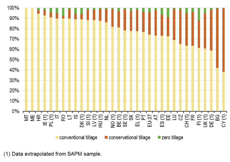
File:Tilled arable area by tillage practice, EU-27, IS, NO, CH, ME and HR, 2010.png
Size of this preview: 800 × 565 pixels. Other resolutions: 320 × 226 pixels | 905 × 639 pixels.
Original file (905 × 639 pixels, file size: 17 KB, MIME type: image/png)
Tilled arable area by tillage practice, EU-27, IS, NO, CH, ME and HR, 2010
Figure created with data from 2010
Data extracted from FSS and SAPM at 24-06-2013
File usage
There are no pages that use this file.