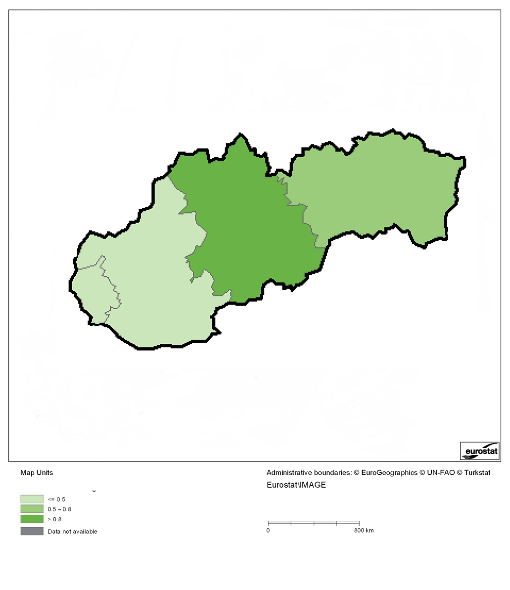
File:Composite indicator of the risk of farmland abandonment based on drivers D1, D2, D3, D4 and D7, normalised for Slovakia, 2006 - 2008.png
Size of this preview: 518 × 599 pixels. Other resolutions: 207 × 240 pixels | 1,031 × 1,193 pixels.
Original file (1,031 × 1,193 pixels, file size: 148 KB, MIME type: image/png)
Composite indicator of the risk of farmland abandonment based on drivers D1, D2, D3, D4 and D7, normalised for Slovakia, 2006 - 2008
Map created with data from 2006-2008.
Data extracted in March 2013. Source:
DG AGRI - FADN database
EUROSTAT - FSS
EuroRegionalMap 2.2 (EuroGeographics)
Urban morphological zones 2000 (EEA)
Urban Audit 2007 (DG Regio)
SRTM mosaic Europe (JRC)
CORINE Land Cover 2006 (EEA)
File usage
There are no pages that use this file.