The Statistical Atlas is an interactive viewer for statistical maps. It contains all the maps from the latest Eurostat regional yearbook and allows you to select maps with a range of backgrounds and features such as cities, roads, lakes and rivers.
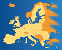
For example, the map below shows the percentage of people aged 16-74 in 2017 who were daily internet users, with different colours denoting different proportions of users in each NUTS 2 region.
With Statistical Atlas you can:
- select the statistics of interest based on the regional yearbook data
- zoom in and out of Europe and its outermost regions
- change the transparency settings of different map layers.
To explore how Statistical Atlas can help you view maps for a range of different statistical topics, click here.
For more information contact us: eurostat-user-support@ec.europa.eu .