Merging statistics and geospatial information, 2015 projects - Croatia
This article forms part of Eurostat’s statistical report on Merging statistics and geospatial information: 2019 edition.
Final report 20 December 2017
Full article
Problem
Having developed geospatial information for population grid-based data from the 2011 census, the Croatian Bureau of Statistics (CBS) noted that users were requesting similar (but unavailable) information from the business register.
Objectives
The objective of this project was to analyse the (spatial/grid-based) distribution of businesses (legal units) according to their economic activity and legal form.
Method
The State Geodetic Administration (National Mapping Agency) was the source of information for maps, centroids and shapefiles. The spatial statistical register (PSR) and the statistical business register (eSPRi) were used to link businesses. Two shapefiles were used, one containing information on 1.6 million addresses, each with an ID and detailed address information, and the other with a 1 km² grid.
The PSR contains data on spatial units for statistics at NUTS levels 1 to 3 and for local administrative units (LAU) level 2 (municipalities), as well as for local self-government units, settlements, statistical circles, statistical enumeration areas, streets/squares, house numbers, households and others; these data are kept in alphanumeric and graphical formats.
The eSPRi contains information on business entities (legal entities and natural persons), their parts and groupings, which were institutionally and formally involved in production and financial processes in the national economy. The eSPRi contains the following attributes (depending on the type of unit): a unique identifier, name, spatial features, size, economic activity, number of employed persons and turnover.
Street names taken from source registers (such as the court register) were matched with data from the PSR. Street codes were then taken over from the SPR and saved in the eSPRi. When a street name in eSPRi could not be automatically linked with the official street name in the PSR, the linking was done manually using an application for street coding and the new links were saved in a thesaurus (which was a component in the application). Each new entry in the thesaurus increased the share of automatically coded streets when new addresses were entered into the eSPRi.
Once the addresses of businesses had been corrected and coded in the eSPRi the active legal units in the eSPRi could be linked with geospatial information. Out of 137 thousand active legal units, 120 thousand units were matched using their address information. Thereafter, other matching techniques were used until matching was complete, for example matching streets within grids rather than with their full address, or matching to the centroid of a settlement. Once all of the legal units had been matched, they could be assigned to a grid cell based on their coordinates.
Once a complete dataset was available it was possible to compile indicators for each grid cell, calculating the number of legal units in each cell according to economic activity and/or legal/organisational form. For the latter, six groups were established: companies; co-operatives; associations; institutions; funds and organisations; state government bodies and bodies of local and regional self-government units.
Results
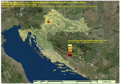
Based on the final dataset a series of maps were developed showing the density of legal units based on 1 km² grid cells. These maps showed the density for various activities (such as agriculture, forestry and fisheries; industry and construction; services) and for the six different legal/organisational forms.
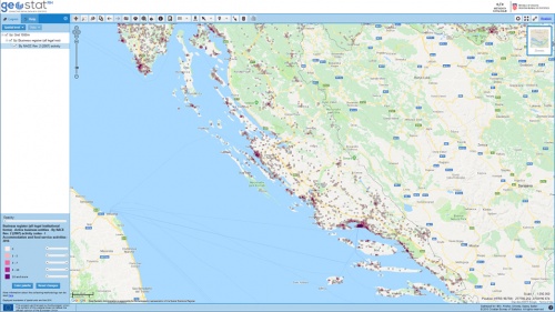
Furthermore, the data are available through the GeoStat application on the statistical office’s website.
Direct access to


