Farm structure (ef)

National Reference Metadata in ESS Standard for Quality Reports Structure (ESQRS)

Compiling agency: Statistics Austria


Eurostat metadata
Reference metadata
1. Contact
2. Statistical presentation
3. Statistical processing
4. Quality management
5. Relevance
6. Accuracy and reliability
7. Timeliness and punctuality
8. Coherence and comparability
9. Accessibility and clarity
10. Cost and Burden
11. Confidentiality
12. Comment
Related Metadata
Annexes (including footnotes)


For any question on data and metadata, please contact: EUROPEAN STATISTICAL DATA SUPPORT

Download


1. Contact Top
1.1. Contact organisation
Statistics Austria
1.2. Contact organisation unit

Directorate Spatial Statistics

Agriculture and Forestry 

1.5. Contact mail address

Statistics Austria

Directorate Spatial Statistics

Guglgasse 13

1110 Vienna

Austria 


2. Statistical presentation Top
2.1. Data description
1. Brief history of the national survey 
Austria conducted its first survey of all agricultural and forestry holdings in 1902. Subsequent farm surveys were held in 1930, 1939 and 1951, and every ten years from 1960 to 1990. These were interspersed with land-use surveys, conducted every three to four years, and, as from 1973, labour-force surveys. Surveys of machinery and equipment were also carried out separately at six-year intervals. The first Farm Structure Survey based on a random sample was conducted in 1993, but the questionnaire was still largely based on the variables of the 1990 Agricultural Census for the sake of comparability in the continuation of the national time series. It nevertheless incorporated some initial adjustments to bring it closer into line with EU requirements while taking account of Austria's own needs. The questionnaire for the 1995 survey was completely aligned with the EU's list of variables in the year of accession. Following a consequent recommendation by the Working Party of the special advisory subcommittee on Agricultural Statistics, a full survey was conducted. Another sample survey was carried out in 1997, and Austria was permitted for the first time to use administrative data. The European Union intended the Farm Structure Survey to be carried out in the form of a comprehensive census at the turn of the decade, with the Member States able to choose between 1999 and 2000. In Austria, the FSS took place in 1999. The Farm Structure Surveys 2003, 2005, 2007 and 2013, in common with that of 2016, took the form of a sample survey. The Farm Structure Survey 2010 was conducted in form of a census. The next census is planned for 2020, the next sample survey for 2023. 


2. Legal framework of the national survey 
- the national legal framework At national level, Austria's Federal Minister for Agriculture and Forestry, Environment and Water Management (MoA) adopted the Regulation (BGBl. II No 243/2016) regarding the preparation of statistics concerning the structure of the agricultural holdings in the year 2016 on the basis of the Federal Statistics Act 2000, BGBl. I No 163/1999, as last amended by BGBl. I No 136/2001BGBl. I No 71/2003BGBl. I No 92/2007BGBl. I No 125/2009, BGBl. I No. 111/2010 and BGBl. I No 40/2014
- the obligations of the respondents with respect to the survey Obligation to provide information

Article 9 of the Federal Statistics Act 2000, as amended on survey variables lays down an obligation to provide information insofar as it cannot be obtained from administrative data. Physical and legal persons and partnerships under commercial law who/which operate a statistical unit in their own name are obliged to provide information. Moreover, natural and legal persons and partnerships under commercial law who either operate a selected holding which does not meet the criteria for inclusion in the survey or who sold or closed their holding are required to provide the relevant information in the form of a reasoned nil return. 


Obligation on respondents to cooperate  

Respondents have to provide their information on time, in full and to best of their knowledge. The information can be provided during a telephone interview with specially trained staff of Statistics Austria or independently by filling in an electronic questionnaire (direct respondents).

The deadline for the direct respondents was 28 November 2016. Those farmers, who took the help of the interviewers to complete and submit their questionnaire, either called directly the free hotline – or arranged an interview by sending the reply card back to Statistics Austria, filled in with their telephone number and availability (weekday and time window). This had to be done until 15 November 2016.


Obligations on other persons

The former managers (holders) of statistical units are obliged to cooperate in the identification of the new respondent by Statistics Austria.
- the identification, protection and obligations of survey enumerators Not applicable. 
2.2. Classification system

[Not requested]

2.3. Coverage - sector

[Not requested]

2.4. Statistical concepts and definitions
List of abbreviations 

AA                  Arable Area

AFR                Agricultural and Forestry Register

AMA               Agrarmarkt Austria

BGBl.              Federal Law Gazette

CAP                Common Agricultural Policy of the European Union

EU                   European Union

Eurostat           Statistical Office of the European Communities

FSS                  Farm Structure Survey

IACS               Integrated Administration and Control System

LBG                LBG Österreich GmbH Wirtschaftsprüfung & Steuerberatung manages the network of returning holdings.

LFBIS             The Information System for Agricultural and Forestry Holdings enables the federal government to consolidate data on individual holdings

LFRZ               The Computing and Technology Centre for Agriculture, Forestry and Water

MoA                Federal Ministry of Agriculture, Forestry, Environment and Water Management

NACE             Nomenclature générale des activités économiques dans les Communautés Européennes

NUTS              Nomenclature des Unités Territoriales Statistiques

ÖPUL              The Austrian national programme for the promotion of environmentally friendly and extensive agriculture that protects natural habitats

SAPM              Survey on Agricultural Production Methods

STATcube       Statistics Austria’s statistical database system is the successor to the ISIS database.

TA                   Total Area

VIS                  Veterinary information system
2.5. Statistical unit
The national definition of the agricultural holding
The definition of the holding is consistent with the definition fixed in Regulation (EC) No 1166/2008. „Agricultural holding“ or „holding“ means a single unit, both technically and economically, which has a single management and which undertakes agricultural activities listed in Annex I to the European Parliament and Council Regulation (EC) No 1166/2008 within the economic territory of the European Union, either as its primary or secondary activity. Holdings exclusively maintaining agricultural land in good agricultural and environmental condition (under 01.61 of NACE Rev. 2) are included in the scope of this definition.  

In addition according to a national regulation, statistical units include forestry holdings with at least three hectares of wooded area. These holdings, which only have wooded areas, are included in the national results but not in the dataset delivered to Eurostat.  

2.6. Statistical population
1. The number of holdings forming the entire universe of agricultural holdings in the country
It does not appear relevant to give information about the total number of units registered in the Farm Register (Agricultural and Forestry Register, AFR), which comprehensively records all the agricultural and forestry holdings domiciled in Austria for various purposes and regardless of any threshold. The information would be misleading and has no practical benefit in the context of this methodology report.


2. The national survey coverage: the thresholds applied in the national survey and the geographical coverage
The population for the Farm Structure Survey 2016 included all the agricultural and forestry holdings in the Farm Register (or Agricultural and Forestry Register, AFR), which carry out agricultural and forestry activities and meet the definition below (178832 holdings).

The definition of the holding is consistent with the definition fixed in Regulation No 1166/2008. Agricultural holding“ or „holding“ means a single unit, both technically and economically, which has a single management and which undertakes agricultural activities listed in Annex I to the European Parliament and Council Regulation (EC) No 1166/2008 within the economic territory of the European Union, either as its primary or secondary activity.

Thresholds of the FSS comply with requirements in Article 3.2. of the Regulation (EC) No 1166/2008. Statistical units are, in accordance with § 2 of the National Regulation (BGBl. II No 243/2016) regarding the preparation of statistics concerning the agriculture and agricultural production 2016, agricultural holdings in line with Article 2 lit. a of the Regulation(EC) No 1166/2008, that reach one of the following thresholds:

  1. 1 hectare utilized agricultural area (UAA)
    (A_3_1>=1ha);
  2. Wine-growing holdings with at least 25 ares under market vines
    (B_4_4>=0.25ha);
  3. Holdings with at least 15 ares of intensively utilized fruit orchards, or 10 ares under berries, strawberries, vegetables, hops, flowers or decorative plants, or tree-, forest- and viticultural nurseries
    (B_4_1_1>=0.15ha or B_4_1_2>=0.1ha or B_1_7_1strawberries>=0.1ha or B_1_7_1vegetables>=0.1ha or B_1_6_2 >=0.1ha or B_1_8_1>=0.1ha or B_4_5>=0.1ha);
  4. Holdings which operate greenhouses (high/low glass or foil) covering at least one are, the majority of the produce being grown for market
    (B_1_7_2+B_1_8_2>=0.01ha;
  5. Livestock holdings with at least three head of cattle, five pigs, 10 sheep, 10 goats or 100 head of poultry of any type
    (C_2>=3heads or C_3_1>=10heads or C_3_2>=10heads or C_4>=5heads or C_5>=100heads).
  6. In addition according to a national regulation, statistical units include forestry holdings with at least three hectares of wooded area
    (B_5_2>=3ha).
Geographical coverage: Austria


3. The number of holdings in the national survey coverage 
Number of holdings in the final weighted population of the survey reference year, according to the national survey coverage described in item 2. in concept 2.6: 
162000 holdings (according to the national definition including forestry holdings with exclusively wooded area of three hectares and more).


4. The survey coverage of the records sent to Eurostat

A dataset of 26186 holdings was sent to Eurostat (see table in 3.3. Data collection - item 4. Monitoring of response and non-response, row 5). This dataset comprises all holdings of the sample meeting the EU thresholds. Excluded in this dataset are forestry holdings which are relevant exclusively due to a wooded area of three hectares and more. 

The national dataset comprises round 29000 holdings (including those forestry holdings, which are relevant exclusively due to a wooded area of three hectares and more).


5. The number of holdings in the population covered by the records transferred to Eurostat

Number of holdings in the final weighted population of the survey reference year, according to the data transmitted to Eurostat: 132501 holdings 


6. Holdings with standard output equal to zero included in the records sent to Eurostat

Statistics Austria does not calculate the standard output of holdings.

6 holdings in the sample with SO=0 have fallow land and/or permanent grassland no longer in production purposes and eligible for subsidies. This land is kept in good agricultural and environmental conditions.


7. Proofs that the requirements stipulated in art. 3.2 the Regulation 1166/2008 are met in the data transmitted to Eurostat
Austria uses a threshold for the UAA of 1 hectare. Therefore the survey does not have to comply with Article 3.2 of the Regulation (EC) No 1166/2008.


8. Proofs that the requirements stipulated in art. 3.3 the Regulation 1166/2008 are met in the data transmitted to Eurostat
Thresholds of the FSS comply with requirements in Article 3.3 of the Regulation (EC) No 1166/2008. Statistical units are, in accordance with § 2 of the National Regulation BGBl. II No 243/2016 regarding the preparation of statistics concerning the agriculture and agricultural production 2016, agricultural holdings in line with Article 2 lit. a of the Regulation (EC) No 1166/2008, that reach one of the following thresholds:
  1. 1 hectare utilized agricultural area (UAA);
  2. Wine-growing holdings with at least 25 areas under market vines;
  3. Holdings with at least 15 ares of intensively utilized fruit orchards, or 10 ares under berries, strawberries, vegetables, hops, flowers or decorative plants, or tree-, forest- and viticultural nurseries;
  4. Holdings which operate greenhouses (high/low glass or foil) covering at least one are, the majority of the produce being grown for market;
  5. Livestock holdings with at least three head of cattle, five pigs, 10 sheep, 10 goats or 100 head of poultry of any type.
2.7. Reference area
Location of the holding. The criteria used to determine the NUTS3 region of the holding
The criteria used to determine the NUTS3 region of the holding in descending order:
  • the address of the farm, which is synonimous with the main agricultural building in most of the cases and which may differ from the mailing address or residential address of the farmer.
  • In the case of common land units (alpine pastures), which usually do not have an address in the conventional sense,  the coordinates of the alpine hut was used.
  • In cases where there was not even a hut, the coordinate was set manually in the center of the areas belonging to the common land unit.   
2.8. Coverage - Time
Reference periods/dates of all main groups of characteristics (both included in the EU Regulation 1166/2008 and surveyed only for national purposes)
The reference periods/dates from the Regulation 1166/2008 are respected.

Reference dates of the main groups of national variables are:

  • 1 April 2016 for details regarding livestock data,
  • 15 May 2016 for details regarding ownership conditions and land-area-related survey variables and
  • 31 October 2016 for all other survey variables.

Reference periods of the main groups of national variables are:

  • 1 November 2015 to 31 October 2016 for details regarding livestock feeding, labour force and other gainful activities,
  • 1 October 2015 to 30 September 2016 for details regarding organic farming (land), arable land, land, soil and manure management practices and irrigation,
  • the calendar year 2016 for details regarding livestock, in cases where livestock husbandry holdings have not put up a single head of the reared livestock on the reference day (1 April 2016),
  • 1 January 2014 to 31 December 2016 for support for rural development.
2.9. Base period

[Not requested]


3. Statistical processing Top
1.Survey process and timetable
The steps of the survey organisation  
1. Definition of survey objective and requirements  
1.1. Formation of workgroups for survey organisation; discussion and analysis of the experiences of the 2013 sample survey; suggestions for improvements and checks on their practicability From April 2015
1.2. Consultation of users From July 2015
1.3. Set-up objectives, target population, statistical units, classifications, precision requirements etc. From October 2015
1.4. Drafting of the national Regulation in cooperation with the MoA October 2015 –  April 2016
1.5. Survey promotion September – October 2016
1.6. Publication of the national regulation 7th September 2016
2. Survey design  
2.1. Set-up organisation of the survey (e.g. detailed timetable, specification of resources, costs estimation) April 2015
2.2. Definition of the survey variables October 2015 –  April 2016
2.3. Determining the survey population; checks and release for dispatch July – September 2016
2.4. Design of the sampling frame and sampling procedures; sampling frame construction July – September 2016
2.5. Design, further development and testing of the electronic questionnaire January – September 2016
2.6. Design of the plausibility program by specialists October 2015 – March 2017
2.7. Compilation of other survey documents (instructions for use etc.) January – September 2016
3. Data collection  
3.1. Checks on the availability of administrative data January – July 2016
3.2. Obtaining administrative data September 2016; April 2017
3.3. Printing, addressing and sending the survey documents (external) August – October 2016
3.4. Sample selection October 2016
3.5. Recruitment of temporary telefone interviewers August – October 2016
3.6. Training of telefone interviewers October 2016

Reference date of the survey

last day of the reference period

31 October 2016

31 December 2016

3.7. Fieldwork October 2016 – March 2017
3.8. Reminder and warning procedures December 2016 – April 2017
3.9. Evaluation and assessment of fieldwork July 2017
4. Data processing and validation  
4.1.Programming the plausibility program; design of the plausibility application by the IT Dept. and tests of its functions by specialists, using fictitious holdings June 2016 – April 2017
4.2. Data taken from the electronic questionnaire in tranches for processing by the IT Dept. December 2016 – April 2017
4.3. Data validation (at record level), imputation, plausibility checks, data correction April – October 2017
5. Data compilation  
5.1. Weight calculation and estimation May – December 2017
5.2. Calculation of derived variables May – December 2017
5.3. Calculation of quality indicators (e.g. non-response rates, relative standard errors, coverage errors, bias etc.) November – December 2017
5.4. Aggregation and tabulation - compilation and programming of the tabulation program (STATcube) and of the Eurostat data files May – January 2018
5.5. Validation of aggregated data; checks on results; analysis September – December 2017
6. data analysis September – December 2017
7. data dissemination  
7.1. National dissemination and publication of the results in the form of a press release, rapid report, and publication on the Internet May 2017; December 2017; January 2018
7.2. Transmission of individual data of the FSS 2016 to Eurostat December 2017


2. The bodies involved and the share of responsibilities among bodies
The project team

Statistics Austria bears ultimate responsibility for implementing the Farm Structure Survey. The Farm Structure Survey is one of many projects of the Agriculture and Forestry Sector of the Directorate for Spatial Statistics (Raumwirtschaft). Its specialist team is supported by EDP (electronic data processing) and statistical experts in methodology.

Technical advice concerning the contents is provided by the Working Party of the Advisory Committee on Agricultural Statistics, which comprises leading experts at various relevant institutions/organizations in the agricultural sector.

The main tasks of the project team were:

  • Compiling the survey program in line with EU requirements and taking national requirements into account;
  • Cooperating in drafting the national regulation with the Ministry for Agriculture and Forestry, Environment and Water Management (MoA);
  • Placing information articles in relevant media;
  • Coordination of tasks between special departments and IT Department;
  • Sample design and drawing the sample in cooperation with the statistical experts in methodology;
  • Design of a plausibility program in cooperation with the IT Dept;
  • Compilation of the questionnaire, instructing printers to print the documents, dispatching documents to the respondents;
  • Training the staff in how to execute the survey (hotline agents (permanent staff) and telephone interviewers (temporary staff)); training the staff of Statistics Austria in how to process the survey;
  • The hotline agents (permanent staff) providing respondents with information during the survey phase;
  • Obtaining, processing and combining data from the various sources;
  • Initiating reminder procedures in case of belated respondents;
  • Reminding respondents who had not replied and reporting non-respondents to the competent authorities;
  • Checks on the completeness and plausibility of the data;
  • Specifications for the creation of the database (STATcube - data cube), tabulation, publication and dissemination of results;
  • Processing individual data in line with EU rules, extrapolation and transmission to Eurostat.

Advisory Committee on Agricultural Statistics

The Federal Statistics Act 2000 (BGBl. I No 163/1999, as last amended by BGBl. I No 136/2001BGBl. I No 71/2003BGBl. I No 92/2007BGBl. I No 125/2009, BGBl. I No. 111/2010 and BGBl. I No 40/2014) provides for the creation of Advisory Committees for the various relevant areas of activity. The Farm Structure Survey comes under the aegis of the Advisory Committee on Agricultural Statistics, which comprises experts from various Austrian institutions (representatives of the MoA, the Governments of the Länder, Chambers of Agriculture at Land level, the Austrian Chamber of Agriculture, LBG Wirtschaftstreuhand- and Beratungsgesellschaft (a limited company), the University of Agriculture (Universität für Bodenkultur) etc.). This body is tasked with providing Statistics Austria, which bears ultimate responsibility for the survey as such, with mainly technical advice and support in the planning and implementation of the survey. 


3. Serious deviations from the established timetable (if any)
No significant deviations from the schedule. 
3.1. Source data
1. Source of data
The FSS 2016 was conducted in form of a sample survey. The administrative data (IACS, System for identification and registration of bovine animals (cattle register)), Veterinary Information System (VIS) were integrated into the electronic questionnaire and checked by respondents while completing the questionnaire. The funding data (measures for rural development) were consolidated after the survey with FSS data using the unique identification number of the holding. Details on individual purpose(s) of the use of administrative sources see concept 3.1. Source Data, item 4.3.


2. (Sampling) frame
The frame of the FSS 2016 essentially comprised the active holding units in the Farm Register (or Agricultural and Forestry Register, AFR) meeting the national thresholds applied (178832 units).

The type of frame is a list frame.

The Farm Register is continuously updated in the light of various primary agricultural surveys and by comparison with various types of administrative data (applications for subsidies, social insurance information, necrologies etc.).


3. Sampling design
3.1 The sampling design
The sample was designed as a one-stage stratified random sample of holdings and therefore is a probability design. There is no sub-sampling for some of the variables. The sampling method is systematic sampling with equal probabilities.
3.2 The stratification variables
Selected variables from the Agricultural Census 2010 were basically used for stratification purposes, e.g. total land area, orchards or vineyards, livestock numbers (the most recent data on cattle, pigs, sheep, goats and poultry) and the number of workers.

The holdings in the sampling frame were divided into between 6 and 15 strata depending on NUTS2 (=federal state/province/Land). In Burgenland, Carinthia, Lower Austria, Upper Austria and Styria the strata 1 to 9 were formed by combining the size categories for the variables 'total area in ha (TA)' and 'arable area in ha (AA)'. In Salzburg, Tyrol, Vorarlberg and Vienna the strata 1 to 3 were formed by combining the size categories for the variables 'total area in ha (TA)'. The other strata comprise holdings with a high livestock population, a large labour force or significant fruit/vine cultivation.

For stratification purposes, the conditions shown in Annexes 3.1-3.2. Detailed-stratification-and-delimitations-per-NUTS2 and 3.1-3.2. Stratification-conditions-NUTS 2 had to be met in each Federal State (Land).

3.3 The full coverage strata
Full coverage strata can be found highlighted in grey in the Annex 3.1-3.2. Detailed-stratification-and-delimitations-per-NUTS2, which shows the detailed stratification and delimitations per NUTS2 (=federal state/province/Land). 
3.4 The method for the determination of the overall sample size
The sample survey covered about 30000 holdings. This size of sample guarantees sufficient accuracy. Calculations have shown that the required mandatory specifications regarding simple relative standard errors are satisfied with this sample size. Thus, 17 % of all holdings had to be surveyed.
3.5 The method for the allocation of the overall sample size
The total survey size of 30000 holdings was allocated to the 9 NUTS2-regions (federal states) proportionally to the square root of total area plus number of cows plus number of pigs. Subsequently, within each federal state the survey size calculated in the first step was allocated to the different strata according to Neyman-Pearson. 
3.6 Sampling across time
A new sample is drawn on each occasion. 
3.7 The software tool used in the sample selection
SAS procedure PROC OPTMODEL 
3.8 Other relevant information, if any
Not available 


4. Use of administrative data sources
4.1 Name, time reference and updating

Integrated administration and control system (IACS) including the Austrian program for the funding of environmentally sustainable extensive agriculture that conserves the natural world (ÖPUL)

  • Regulation (EU) No 1307/2013 of the European Parliament and of the Council of 17 December 2013 establishing rules for direct payments to farmers under support schemes within the framework of the common agricultural policy and repealing Council Regulation (EC) No 637/2008 and Council Regulation (EC) No 73/2009, as amended by Regulation (EU) No 1310/2013, and the Commission Delegated Regulations (EU) No 639/2014,  No 994/2014,  No 1001/2014,  No 1378/2014,  and No 2015/851.
  • data are updated every year and used according to the reference dates and periods of the survey (see concept 2.8 Time coverage).

System for identification and registration of bovine animals (Cattle register)

  • Regulation (EC) No 1760/2000 of the European Parliament and of the Council of 17 July 2000 establishing a system for the identification and registration of bovine animals and regarding the labelling of beef and beef products and repealing Council Regulation (EC) No 820/97, as amended  by Council Regulations (EC) No 1791/2006 and No 517/2013 and Regulation  (EU)  No  653/2014 of the European Parliament and of the Council,
  • data are continuously updated and used according to the reference dates and periods of the survey (see concept 2.8 Time coverage).

Register of organic farms (comment: in a strict sense, there is no register of organic farms in Austria, information is taken from IACS/ÖPUL) (information see above).

Measures for rural development

  • Regulation (EU) No 1305/2013 of the European Parliament and of the Council of 17 December 2013 on support for rural development by the European Agricultural Fund for Rural Development (EAFRD) and repealing Council Regulation (EC) No 1698/2005.
  • data are updated every year and used according to the reference dates and periods of the survey (see concept 2.8 Time coverage).

Based on Article 4 (2), Austria requested further the use of following administrative data:  

Veterinary Information System (VIS)

  • Directive 2000/16/EC of the European Parliament and the Council of 10 April 2000 amending Council Directive 79/373/EEC on the marketing of compound feeding stuffs and Council Directive 96/25/EC on the circulation of feed materials; Council Regulation (EC) No 21/2004 of 17 December 2003 establishing a system for the identification and registration of ovine and caprine animals and amending Regulation (EC) No 1782/2003 and Directives 92/102/EEC and 64/432/EEC; Animal Diseases Act – TSG, Act of 6 August 1909, RGBl. No 177, concerning the defense and eradication of animal diseases (as amended in 2008 BGBl. I 2008/36); Animal identification and registration act 2009 BGBl. II No 291/2009: Regulation of the Minister of Health on the identification of pigs, sheep, goats and equidae and the registration of animal husbandry (Animal identification and Registration ordinance 2009; TKZVO 2009); Approved or registered ABP-plants according to Reg. (EC) No 1069/2009; Lists of approved food establishments according to Reg. (EC) No 853/2004 and Reg. (EC) No 852/2004.
  • data are updated every year and used according to the reference dates and periods of the survey (see concept 2.8 Time coverage).
4.2 Organisational setting on the use of administrative sources
Under the Federal Statistics Act 2000, BGBl. I No 163/1999, as amended by BGBl. I No 136/2001BGBl. I No 71/2003BGBl. I No 92/2007BGBl. I No 125/2009, BGBl. I No. 111/2010 and BGBl. I No 40/2014), Statistics Austria is required to use the available administrative data instead of information obtained using its own questionnaires, so as to minimize the respondents' workload.

On the other hand there is an obligation on the holders of administrative data to cooperateAccording to the Regulation (BGBl. II No 243/2016) regarding the preparation of statistics concerning the structure of the agricultural holdings in the year 2016 Agrarmarkt Austria (AMA) is required to transmit the administrative data necessary for collecting the survey variables at the request of Statistics Austria free of charge on an electronic data carrier.

Furthermore according to the Federal Statistics Act the position of Statistics Austria has/would have to be taken into consideration in the conceptual design and subsequent related revisions of the administrative sources. In the light of growing efforts to cut costs and streamline the requests on the administrative side the practical coordination with the statistical requirements might not allways be optimally implemented and has to be compensated by recoding or by directly asking the farmers in individual issues. Most effective would be the precise coordination of administrative and statistical concepts and requirements already at European level.

4.3 The purpose of the use of administrative sources - link to the file
Please access the information in the file at the following link:  (link available as soon as possible)


4.4 Quality assessment of the administrative sources
  Method  Shortcoming detected Measure taken
- coherence of the reporting unit (holding) The definition of the reporting unit in FSS is the same as the one used for the subsidy system and the related administrative data. In this context quality is ensured by the routine maintenance of the Agricultural and Forestry Register, which is continuously updated in the light of various primary agricultural surveys and by comparison with various types of administrative data (applications for subsidies, IACS, VIS, social insurance information etc.).  ---  ---
- coherence of definitions of characteristics IACS including ÖPUL:

Correlations between the variables were assessed. Area data has to be provided by 15 May of the current harvest year. The record day of the area data correlates with the record day of the IACS data (15 May 2016). Information on ecological farming has to be provided by 15 November.

IACS including ÖPUL:

Essentially, there is a good correlation between the variables.
In the AMA multiple application, area data are often recorded more detailed in Schlagnutzungsarten (land parcels).
In a very small minority of cases variables may not be covered sufficiently by administrative data

IACS including ÖPUL:

Transition tables were used for aggregating land parcels from IACS to the required FSS categories.
In isolated cases Statistics Austria had to assign the IACS data to relevant items in the FSS program.
Not sufficiently by administrative data covered variables, were entered into the electronic questionnaire in the frame of the FSS 2016 by respondents. 

Cattle register:

Correlations between the variables were assessed.
Record day of cattle data (FSS) correlates with the record day of the cattle data base (1 April 2016).

Cattle register:

The cattle register contains the complete bovine categories, with exception of dairy cows/other cows, for the breakdown of individual items in accordance with the guidelines of the FSS.

Cattle register:

The number of cows and the total number of cattle for the reference date 1 April 2016 was integrated into the electronic questionnaire. The respondents had to divide the number of cows into dairy cows and other cows in questionnaire. The detailed information (categories) of the rest of the cattle was consolidated after the survey with FSS data using the unique identification number of the holding.

- coverage:      
  over-coverage IACS including ÖPUL, Cattle register, Measures for rural development, VIS:

Over-coverage is excluded. 

 --- IACS including ÖPUL, Cattle register, Measures for rural development, VIS:

Out-of scope units were excluded.

  under-coverage IACS including ÖPUL:

Unreported events of units, which can be considered by themselves as covered by administrative data, are excluded due to the control- and sanctioning mechanisms (see also comparability below). 

IACS including ÖPUL:

Data are only available for holdings which submit a multiple application to Agrarmarkt Austria.

IACS including ÖPUL:

Holdings which do not submit a claim in a particular year are required to make the data available in the course of the FSS.

Measures for rural development:

100% coverage by administrative data.

--- ---
Cattle registerVIS:

Unreported events of units, which can be considered by themselves as covered by administrative data, are excluded due to the control- and sanctioning mechanisms (see also comparability below).

Cattle registerMeasures for rural development, VIS:

Data are only available for agricultural holdings keeping livestock which require to be reported by the VIS full survey or submit an IACS funding request.

Cattle registerMeasures for rural development, VIS:

Agricultural holdings keeping livestock which neither require to be reported by the VIS full survey nor submit an IACS funding request have to provide the information about livestock as part of the Farm Structure Survey. This applies only to very few holdings keeping exclusively poultry, horses or farmed game.

   misclassification IACS including ÖPUL, Cattle register, Measures for rural development, VIS:

Misclassification is excluded.

--- --- 
  multiple listings IACS including ÖPULCattle register, Measures for rural development, VIS:

There are no multiple listing errors due to the use of a unique registration code for each holding. 

--- ---
- missing data IACS including ÖPUL: The occurrence of  variables were assessed. IACS including ÖPUL:

There are missing data on B_1_7 Fresh vegetables, melons, strawberries, B_1_8 Flowers and B_2 Kitchen gardens.

IACS including ÖPUL:

The respondents are required to make the data available in the course of the FSS.

Cattle registerVIS:

Missing data are excluded due to the control- and sanctioning mechanisms.

--- ---
- errors in data IACS including ÖPUL:

In situ inspections are carried out at farmers’ premises by AMA as part of the IACS and false declarations punished by reductions in premiums. Statistics Austria is using already checked data (September). Therefore it can be assumed that the administrative data are highly accurate. The use of a digital cadaster map (DCM) is also expected to yield accurate information on areas.

---   --- 
Cattle register:

A series of checks are performed in the course of the administrative process, this allows that the use of data from the Cattle Register makes for a greater accuracy and reliability of the results for a cattle population.

---  --- 

VIS:
The annually on 1 April surveyed data were integrated into the VIS database. As these administrative data underlie continuous controls, a great accuracy and reliability of the results can be assumed.

---  --- 
- processing errors IACS including ÖPULCattle registerMeasures for rural development, VIS:

In principle there are no processing errors in the context with the use of administrative data due to the use of unique identifiers on both sides (administration and statistics).

--- IACS including ÖPULCattle registerMeasures for rural development, VIS:

Nevertheless, by prefilling the administrative data (IACS and VIS) concerning areas and livestock into the electronic questionnaire the respondents would have the opportunity to check and correct the data while completing the electronic questionnaire.

- comparability   


IACS including ÖPUL:

In 1995 the information in the IACS was compared with the results of  agricultural surveys carried out in the traditional manner (Farm Structure Surveys and livestock censuses). 

IACS including ÖPUL:

Comparison of the items revealed a very good match with the agricultural surveys.

IACS including ÖPUL:

Nevertheless, by prefilling the administrative data concerning areas into the electronic questionnaire the respondents would have the opportunity to check and correct the data while completing the electronic questionnaire. In case of large discrepancies the farmers would have been recalled.

Cattle register:

Comparisons were made between the analyses of the Cattle Register and the results of the livestock censuses. The data were checked as part of the application to use administrative data from the Cattle Register instead of statistical cattle surveys.

Cattle register:

There was a close correlation between the results of this source and the livestock censuses. 

--- 
VIS:

Comparisons of VIS data were made with results from statistical surveys.

VIS: Comparisons suggest a very good correlation between this source and the results from statistical surveys. VIS:

Nevertheless, by prefilling the administrative data concerning livestock into the electronic questionnaire the respondents would have the opportunity to check and correct the data while completing the electronic questionnaire. In case of large discrepancies the farmers would have been recalled. 

 ---  ---   Austria runs the FSS late in the year for the sake of optimising the use of administrative data. To an earlier date the administrative data would not be available in the same (verified and highly consistent) quality to pre-fill answers in the questionnaires which are then checked by farmers during the survey.  
- other (if any)

--- 

 
--- IACS including ÖPULCattle registerMeasures for rural development, VIS:

In isolated cases data had to be aggregated.   


4.5 Management of metadata
IACS area data and lifestock data are stored in the Farm Register (or Agricultural and Forestry Register, AFR).  If available, Metadata of IACS, ÖPUL, Cattle register, VIS and Measures for rural development are stored and maintained in electronic format. 
4.6 Reporting units and matching procedures
Integrated administration and control system (IACS) including ÖPUL, System for identification and registration of bovine animals (cattle register), Measures for rural development, Electronic Veterinary Register pursuant to §8 Animal Diseases Act (TSG) – Veterinary Information System (VIS):

The reporting unit (statistical unit) used is the agricultural and forestry holding. Around 14% of holdings includes two or more sub-holdings (in many cases, these are alpine pasture units). The definition of the reporting unit meets the definitions used for the subsidy system and the related administrative data. Every agricultural and forestry holding (resp. subholding)  has a unique identification number, that is used in subsidies as well as in the frame of statistical surveys. The assignment between various data sources is done with this unique identification number (exact matching procedure). There were no mismatching cases.

4.7 Difficulties using additional administrative sources not currently used
Not existing.


Annexes:
3.1-3.2. detailed-stratification-and-delimitations-per-NUTS2
3.1-3.2. stratification-conditions-NUTS2
3.2. Frequency of data collection
Frequency of data collection
The frequency of the surveys/data collection is determined by the European legislation and each survey is dealt with under a separate national regulation. 
3.3. Data collection
1. Data collection modes
The Farm Structure Survey was held solely using an electronic questionnaire (e-Quest). The farmers were able to submit their return either directly at the computer after entering their user ID and password (direct respondents, CAWI) or during a personal interview by telephone using the same electronic questionnaire (CATI). About 60% of the questionnaires were returned by direct respondents. About 40 % of the respondents provided information by means of telephone interviews.

Those farmers, who took the help of the telephone interviewers to complete and submit their questionnaire, either called directly the free hotline or arranged an interview by sending a prepaid reply card back to Statistics Austria, filled in with their telephone number and availability (workday and time window). The competent interviewers opened the farmer’s survey form using the farmer’s access data and filled out the electronic questionnaire with the necessary information.

The survey took the form of a personalised electronic questionnaire, in which the name and the address of the holdings were already entered and only had to be checked and, if necessary, corrected. Detailed information material on how to use the electronic questionnaire and administer the Farm Structure Survey was sent directly to the respondents by post in October 2016. These consisted of an accompanying letter, a survey manual with a full description of the electronic questionnaire and a reply card (to arrange an interview) with a prepaid envelope.

A dedicated free hotline was set up by Statistics Austria to answer any questions that arose during the survey phase. In addition, queries could be sent by e-mail to Agrarstrukturerhebung@statistik.gv.at.


2. Data entry modes
Due to an exclusive use of the electronic questionnaire, no separate data collection was necessary. The data were entered by the respondents (CAWI) or by the telefone interviewers (Electronic data capture during telephone interview, see above). The data of only very few holdings, who submitted their questionnaire by mail or fax to Statistics Austria, had to be entered manually into the electronic questionnaire.

The IT department took the data directly from the questionnaire in tranches and imported it into a database.


3. Measures taken to increase response rates
The following measures were taken to increase response rates.

Maintaining up-to-date information in the Farm Register (or Agricultural and Forestry Register, AFR)

The Farm Register (or Agricultural and Forestry Register, AFR) on which the FSS is based is constantly being enhanced in terms of technical aspects and content maintenance as a result of increased updating options (administrative data, other registers etc.). In the run-up to the survey additional measures were taken to improve the up-to-dateness (e.g. adjustments with necrologies etc.).


Awareness campaign

Concerted articles were published in the relevant newspapers, journals and web pages to inform on the survey, its purposes and the importance of cooperation.


Trainings

  • Training of all hotline agents (permanent staff of Statistics Austria) engaged in the FSS.
  • Training of all telephone interviewers (temporary staff) engaged in the FSS.


Hotline-strategy

For the hotline staff and telephone interviewers at Statistics Austria, a list of frequently asked questions with regard to the motivation of respondents was compiled as a means of preparing them for questions from "difficult" respondents. Hotline agents were trained to convince respondents, who called and signalised to boycott the FSS, to give the information via direct telephone interview. Regular meetings of the hotline agents and the issue of newsletters facilitated information flows. 


Telephone Interviews

Although the relatively low return quota of the reply cards (to arrange an interview) requires further improvement (only about 12,1% reply cards were returned), the farmers very willingly accepted the possibility to provide the information via telephone interview in the end. The low return quota of the reply cards had to be offset by intensified research for telephone contact information in the Farm Register (or Agricultural and Forestry Register, AFR), phone book and internet. 


Reminders for overdue questionnaires

A graded series of reminders for overdue questionnaires was applied.

  • In former surveys the local authorities had to ensure that all questionnaires were returned and it was their responsibility to ask the holdings (either in person, over the telephone, in writing or by registered mail) to complete the questionnaire. Since the FSS 2013 the Austrian local authorities have not been directly involved. Now the holdings were targeted by telephone-interview procedures by staff at Statistics Austria.
  • About 3457 farmers, who had failed to complete the questionnaire on time or who could not be contacted by phone, were reminded and notified of the legal consequences via registered letter.    
  • 93 farmers insisted on their refusal and were ultimately reported by Statistics Austria to the relevant authorities in April 2017 to initiate administrative penal proceedings. Since Statistics Austria has no executive power to pursue administrative penal proceedings, information about these holdings had to be given to the relevant administrative districts that are responsible in Austria for conducting prosecutions. Normally a fine is imposed and a deadline is set for supplying the required information, i.e. payment of the fine does not release the farmer from the duty of supplying information; he/she must still provide the data in all cases.        
  • After prosecution 24 farmers submitted their data properly – if very late in some cases – to Statistics Austria. 69 farmers did not cooperate at all. Their data had to be imputed.


4. Monitoring of response and non-response
1 Number of holdings in the survey frame plus possible (new) holdings added afterwards

In case of a census 1=3+4+5

155314 
2 Number of holdings in the gross sample plus possible (new) holdings added to the sample

Only for sample survey, in which case 2=3+4+5

27728 
3 Number of ineligible holdings 1542
3.1 Number of ineligible holdings with ceased activities

This item is a subset of 3.

498 
4 Number of holdings with unknown eligibility status

4>4.1+4.2

-
4.1 Number of holdings with unknown eligibility status – re-weighted  
4.2 Number of holdings with unknown eligibility status – imputed  
5 Number of eligible holdings

5=5.1+5.2

26186
5.1 Number of eligible non-responding holdings

5.1>=5.1.1+5.1.2

69 
5.1.1 Number of eligible non-responding holdings – re-weighted
5.1.2 Number of eligible non-responding holdings – imputed 69 
5.2 Number of eligible responding holdings 26117 
6 Number of the records in the dataset 

6=5.2+5.1.2+4.2

26186 


5. Questionnaire(s) - in annex
 See annex.


Annexes:
3.3-5. Questionnaire_2016_AT
3.4. Data validation
Data validation
Edit rules/checks

Micro-level processing was carried out by means of extensive plausibility checks. The formal checks on the data involved a plausibility program containing about 196 plausibility rules, which again included all the controls of the Data Suppliers Manual. The types of checks performed were completeness checks, data validation, valid value checks, range checks, relational checks, arithmetic checks, ratio edits.

The plausibility rules made distinctions between the following types of error:

  • Automatic errors      
    These were errors that could be automatically corrected using programmed instructions.
  • Information errors (100)      
    This mainly involved identifying input errors. Limit values were incorporated into the program for certain items in particular, e.g. to prevent entries being made in the wrong units of measurement (for example m²) in the case of specialised crops. If these limits were exceeded, this fact was reported. Processing staff then had to investigate or use their specialised knowledge to confirm that the data were correct or make the necessary corrections.
  • Other errors (96)    
    Processing staff had to correct these, either by recalling/consulting the respondents or on the basis of their specialised knowledge.


Moreover, the nil returns were examined. If, for example, administrative information on the holding was available, the holding was surveyed again. This was done in close collaboration with staff dealing with the Farm Register (or Agricultural and Forestry Register, AFR), as the information from the nil returns (business closure, leasing, etc.) were used for updating the registers.


Tools used for data validation

Application for Plausibility checks

The data sets were checked for missing, incorrect or implausible information, using an extensive plausibility application. The program was developed in cooperation with the IT Dept. Care was taken to ensure that missing, incorrect and implausible entries were detected by the program and either highlighted or immediately corrected. The functionality of the plausibility program was first checked using fictitious holdings. The correction applications contained a number of deliberate errors in order to check whether the program would recognise and report them.

For the FSS 2016 about 81 % of the questionnaires needed further checking due to information errors or "real" errors. This share was higher than in 2013 due to the variables concerning soil and manure management practices. For each holding, all errors and information errors were listed and categorised.

The errors detected (incorrect entries, missing or implausible data) had to be investigated and rectified by the processing team. Errors were eliminated and plausibility checks carried out directly via the application. Holdings for which errors still remain are flagged as incorrect and had to be processed once again. This process was repeated until the program detected no more errors or inconsistencies. The staff themselves could correct logical obvious errors. Frequent meetings of the staff facilitated information flows. Discussing the main issues arising from the work made it easier to standardise the criteria to solve similar situations.

Missing or incorrect entries were completed from other data sources wherever available (e.g. administrative data from IACS or ÖPUL, “total area information” from the social insurance for farmers) to avoid burdening the respondents. The forestry yearbook, containing the areas of Austria’s largest forestry holdings, was another means of checking data. If these sources were not exhaustive, individual items from the 2010 or 2013 Farm Structure Survey were used, wherever possible, to supplement and/or check the data. Where this did not provide clarity, individual holdings had to be contacted by telephone.


Figure: Plausibility application - search function


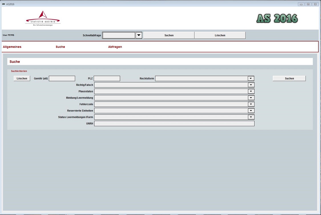
Level of data validation

At the level of the Electronic questionnaire (respondent/telefone interviewer)

The questionnaire was designed in such a way that certain data items were checked for plausibility and for completeness respectively while being entered or before the questionnaire could be returned, with the result that serious errors did not go undetected and were not accepted. In order not to overload the questionnaire application and make it unnecessarily difficult for the respondents to use, this immediate plausibility check had to be limited to the most important content. Preventive measures were also taken to avoid instances of individual questionnaire sheets inadvertently being "skipped over": the marker was required to enter "The entries on this page are complete" on every page of the questionnaire. The checks in the electronic questionnaire included completeness checks, valid value checks, relational checks.


At the level of the Application for Plausibility checks (processing team) 

Formal checks on the data imported into the database involved the plausibility program mentioned above. 

3.5. Data compilation
Methodology for determination of weights (extrapolation factors)
1. Design weights
Design weights were obtained by taking the inverse of selection probabilities of holdings. 
2. Adjustment of weights for non-response
The response rate was ultimately 99.77%. The data of the 69 units which refused to fill in the questionnaire, could be imputed by using administrative or other data-sources (Internet etc.). Therefore no re-weighting for non-response was necessary.

Non-response because of non-existence of holdings at the time of the data collection: No adaption of sample weights necessary.

3. Adjustment of weights to external data sources
The weights were not adjusted to external sources. 
4. Any other applied adjustment of weights
No other adjustment of weights. 
3.6. Adjustment

[Not requested]


4. Quality management Top
4.1. Quality assurance

[Not requested]

4.2. Quality management - assessment

[Not requested]


5. Relevance Top
5.1. Relevance - User Needs
Main groups of characteristics surveyed only for national purposes 
In order to satisfy both national needs and various Directives, the survey of the individual variables was more detailed for certain groups. Those variables were aggregated prior to transmission to Eurostat in line with the rules for the provision of FSS data (see Annex 5.1 national-variables)


Annexes:
5.1. national-variables_FSS2016
5.2. Relevance - User Satisfaction

[Not requested]

5.3. Completeness
Non-existent (NE) and non-significant (NS) characteristics - link to the file. Characteristics possibly not collected for other reasons
Please access the information in the file at the following link: (link available as soon as possible)
5.3.1. Data completeness - rate

[Not requested]


6. Accuracy and reliability Top
6.1. Accuracy - overall
Main sources of error
The main source of errors in the survey are sampling errors.

In all cases where precision requirements are applicable the precision requirements are met.  The relative standard errors (RSEs) are below the thresholds stipulated in Annex IV "Precision Requirements" of the Regulation 1166/2008. 

Especially in strata with a high weight the extrapolation of variables with a very low frequency may lead to high sampling errors. 

6.2. Sampling error
Method used for estimation of relative standard errors (RSEs)
The customary standard formulae for estimation of RSEs is shown in Annex 6.2_formula-RSE_Austria.


Annexes:
6.2. Formula RSE Austria
6.2.1. Sampling error - indicators

1. Relative standard errors (RSEs) - in annex


2. Reasons for possible cases where precision requirements are applicable and estimated RSEs are above the thresholds
In all cases where precision requirements are applicable the precision requirements are met. The estimated RSEs are below the thresholds stipulated in Annex IV "Precision Requirements" of the Regulation 1166/2008. 


Annexes:
6.2.1-1. relative-standard-errors_FSS2016
6.3. Non-sampling error

See below

6.3.1. Coverage error
1. Under-coverage errors
There is no under-coverage of agricultural holdings, because newly created holdings usually submit subsidy applications and their administrative data are used for inclusion in the Farm Register (or Agricultural and Forestry Register, AFR). Wrongly classified units can be ruled out due to the routine maintenance of the AFR with checks against various types of administrative data (applications for subsidies, social insurance information etc.).


2. Over-coverage errors
Since holdings are identified by a unique holding number and they have only one chance of selection in the sample and only one return can be submitted for each holding number, there has been practically no over-recording.

In the case of non-response due to non-existence of holdings (ceased activity) or when holdings fell below the thresholds at the time of the data collection the sample weights were not adapted.

2.1 Multiple listings 
Did not occur. 


3. Misclassification errors
Did not occur. 


4. Contact errors
About 500 holdings (approximately 1.66 % of the sample) whose documents were returned to Statistics Austria as undeliverable because of incorrect or incomplete addresses were identified with the help of the communes or the internet and the documents were resent. 

Documents had to be reissued to 955 holdings because they lost or “mislaid” their documents. 4 holdings had their documents sent 2 times.


5. Other relevant information, if any
Not applicable. 
6.3.1.1. Over-coverage - rate
Over-coverage - rate
The frame essentially comprised active holdings in the Farm Register (or Agricultural and Forestry Register, AFR) meeting the thresholds of the FSS. According to the national definition (including holdings with more than 3 ha forest) there were 178832 units and 155314 units according to the EU definition. Quality of the frame is ensured by the routine maintenance of the Agricultural and Forestry Register (AFR), which is continuously updated in the light of various primary agricultural surveys and by updates/comparison with various types of administrative data (applications for subsidies, social insurance information, necrologies etc.).

The target population of the FSS 2016 comprises about 162000 units (national) and 132501 units (EU). 

Per definition the over-coverage rate (EU) would be 14.7%. The proportion of out of scope units in the sample (EU) is 5.6%. 

6.3.1.2. Common units - proportion

[Not requested]

6.3.2. Measurement error
Characteristics that caused high measurement errors
The recording errors that were made by respondents (e.g. wrong unit of measurement for cultivated area) were able to be adjusted during the plausibility checks.

There were no variables with high measurement errors. Occasionally respondents transfered area data, which was not prefilled by administrative sources (e.g. forest area) from their land register without considering diverging units of area. Others had difficulities to convert masses to volume (national variables - manure application). Errors concerning diverging units of area were detected by checking the data against previous surveys.

6.3.3. Non response error
1. Unit non-response: reasons, analysis and treatment
The main reason for unit non response is the lack of willingness to bear the burden of filling in the questionnaire or to contact the hotline or to be available for a telefone-interview. 

In the end 69 units refused to fill in the questionnaire. Their data could be imputed by using administrative or other data-sources (Internet, etc.). As this number is very low and  fairly equally distributed, no further analysis was made.


2. Item non-response: characteristics, reasons and treatment
In general it is obvious that the risk of non-response tends to be higher in the context of variables, which might be considered to be more confidential by the respondents or which can hardly be cross-checked. In the hindsight it is not possible to quantify non-response across holdings´ categories. 

Item non-response is reduced by the electronic questionnaire, which was designed in such a way that it could only be sent once the compulsory fields had been correctly completed. To prevent individual pages of the questionnaire being inadvertently missed out, a marker was placed on each page of the internet questionnaire which had to be set to signify that the page had been completed. There were also cross-checks between dependent items in the questionnaire (e.g. lifestock - manure). This range of welltargeted measures made it possible to reduce the item non-response rate. In the paper-based questionnaires in previous surveys, variables frequently came back uncompleted.       

In addition, various tests and monitoring measures were carried out during the plausibility checks. Missing data could be imputed after contacting the respondents again or by using other data-sources (internet etc.).

6.3.3.1. Unit non-response - rate
Unit non-response - rate
EU sample: 69/26186 = 0.26%; National sample: 0.24% 
6.3.3.2. Item non-response - rate
Item non-response - rate
Item non response can virtually be excluded for the main variables, if not for most variables due to the measures mentioned above (electronic questionnaire). Occasional imputations cannot be quantified. 
6.3.4. Processing error
1. Imputation methods
Missing or incorrect entries were completed from other data sources wherever available (e.g. administrative data from IACS or ÖPUL, “total area information” from the social insurance for farmers) to avoid burdening the respondents. The forestry yearbook, containing the areas of Austria’s largest forestry holdings, was another means of checking data. If these sources were not exhaustive, individual items from the 2010 or 2013 FSS were used, wherever possible, to check and/or supplement the data. Where this did not provide clarity, individual holdings had to be contacted by telephone.

Moreover, the nil returns were examined. If, for example, administrative information on the holding was available, the nil return was rejected and the holding was surveyed again. This was done in close collaboration with staff dealing with the Farm Register (or Agricultural and Forestry Register, AFR), as the information from the nil returns (business closure, leasing, etc.) were used for updating the registers.


2. Other sources of processing errors
During the FSS 2016 there were no other sources of processing errors (No internet problems affecting completed electronic questionnaires, no incorrect algorithms for data processing and no incorrect coding).


3. Tools used and people/organisations authorised to make corrections
The data sets were checked for missing, incorrect or implausible information, using an extensive plausibility application. The corrections were made by Statistics Austria's project team which were specially trained and authorised to process and rectify the data sets.
6.3.4.1. Imputation - rate
Imputation - rate
The imputation-rate could be kept very low by the measures mentioned in 6.3.3. Non response error - 2. Item non-response, but it cannot be quantified for single characteristics.  
6.3.5. Model assumption error

[Not requested]

6.4. Seasonal adjustment

[Not requested]

6.5. Data revision - policy
Data revision - policy
Preliminary key results are made available in a press release and are replaced with the publication of the final data. FSS might undergo revision of data only if needed but revision is not planned so far.
6.6. Data revision - practice
Data revision - practice
In the course of the press release published on 27 June 2017, important preliminary key results made available on the internet were replaced with the publication of the final data. Beyond that no further data revision is planned so far.
6.6.1. Data revision - average size

[Not requested]


7. Timeliness and punctuality Top
7.1. Timeliness

See below

7.1.1. Time lag - first result
Time lag - first result
6 months; last day of the reference period: 31 December 2016; day of publication of first results: 27 June 2017
7.1.2. Time lag - final result
Time lag - final result
12 Months; last day of the reference period: 31 December 2016; day of publication of final results: 29 December 2017
7.2. Punctuality

See below

7.2.1. Punctuality - delivery and publication
Punctuality - delivery and publication
0 days (release date: 2017/12/29  -   target date: 2017/12/29)

0 days (delivery date: 2017/12/20 -   target date: 2017/12/20)


8. Coherence and comparability Top
8.1. Comparability - geographical
1. National vs. EU definition of the agricultural holding
The definition of the holding is consistent with the definition fixed in Regulation (EC) No 1166/2008. „Agricultural holding“ or „holding“ means a single unit, both technically and economically, which has a single management and which undertakes agricultural activities listed in Annex I to the European Parliament and Council Regulation (EC) No 1166/2008 within the economic territory of the European Union, either as its primary or secondary activity. Holdings exclusively maintaining agricultural land in good agricultural and environmental condition (under 01.61 of NACE Rev. 2) are included in the scope of this definition.  

Increased use of administrative data made an adaptation according to the subsidy requirements necessary. The FSS 2016, 2013 and the Agricultural Census 2010 defined, in contrast to previous surveys, the holding as company (main holding) that includes all production units (part holdings) sharing labour and means of production.

In addition according to a national regulation, statistical units include forestry holdings with at least three hectares of wooded area. These holdings, which only have wooded areas, are included in the national results but not in the dataset delivered to Eurostat.


2.National survey coverage vs. coverage of the records sent to Eurostat
According to a national regulation, statistical units include forestry holdings with at least three hectares of wooded area. 

The only significant changes to the survey size criteria were made at national level for the 1999 Farm Structure Survey. The changes involved raising the lower limits for land area and the size of livestock herds. Concerning the units, which are relevant for the FSS at European level, the thresholds, which were set following Austria’s accession to the EU Treaty in 1995, have been maintained/kept unchanged ever since. 


3. National vs. EU characteristics
Definitions used in FSS 2016 are mainly based on the Commission Regulation (EC) No 1391/2015. Furthermore, the guidelines according to the „Handbook on implementing the FSS and SAPM definitions” are implemented as far as possible. The latest version used during the organisation of the FSS 2016 (preparation of the questionnaire and manual for the respondents) was version FSS2016_HANDBOOK_vers 2015_11_30 FSS rev1.

Definitions of variables, already different to EU definitions that do NOT affect the comparability with previous survey (census) data:

  • E_1_2,  E_1_3,  E_1_4  and E_1_5 (AWU): The number of hours for a „full-time employee“ was set 2000 hours per year (250 working days of eight hours), whereas the EU Regulation provides for only 1800 hours per year (225 working days of eight hours). As these are only guidelines, and as the European requirements are, according to experts, too low for Austria, the national Working Party of the Agricultural Statistics Advisory Committee decided to increase the number of hours as from the 1995 Farm Structure Survey. This deviation has not changed in time series and can mostly be attributed to specific national circumstances. The worktime percentage bands for the regularly employed  labour force are asked directly by using these bands and on the basis of a 40-hour week. Apparent excessive amounts regarding the labour input (e.g. 100 %  in case of retired people or pupils and students) were reduced considering interacting factors.

National justified changes of the definitions of variables that affect the comparability with previous survey (census) data:

  • E_1_5  (Agricultural area utilised for farming by tenant): In the FSS 2016, FSS 2013 and the Agricultural Census 2010, leased areas within the family (e.g. father to son) are valued as rented areas and not as property of the tenant as in previous surveys (before 2010).
  • B_4_1_2  (Berry species): Starting with the FSS 2016 elderberry (Sambucus nigra L.) was recorded under B_4_6 (Other permanent crops) to ensure a better coherence with crop statistics. Elderberries are used predominantly for industrial purposes.


4. Common land
4.1 Current methodology for collecting information on the common land
Common land has been included in the FSS as special agricultural holdings (AGRARIAN COMMUNITIES) since 1993. In Austria an Agrarian Community is described as an association of real estate property owners, who have a common right of ownership over a piece of land, the so-called common land. The agrarian community is a public body and thus an independent legal body, which can acquire a title and incur debts. The registered owner of the properties is in each case the agrarian community. The affiliation of the individual members to the agrarian community is evident as „portion right“. Each agrarian community must have a chairman, the plenary assembly of all members is the most substantial decision maker and often there is also an executive committee or a committee. There are different possibilities to manage the common land. Predominantly the area is managed jointly (in one unit). Some agrarian communities are a few centuries old, but the legal form “agrarian community” has only been existing since some decades. Previously they were organized in other legal forms. The historical development of the individual agrarian communities can be quite different. Mostly they resulted from common property of farmers of one village/hamlet in alpine pastures or forests.


This approach (separate record) meets the practice of the subsidy system, where common land units themselves can apply for subsidies, are therefore part of administrative data and are treated like other farms. Even though it might be argued that common land does not have any production, any economic value as its economic value is incorporated into the livestock, which graze the common land and which belong to the affiliated agricultural holdings, at least one condition for an agricultural holding is still fulfilled: The maintainance of agricultural land in good agricultural and environmental condition (under 01.61 of NACE Rev. 2).

There were no particular questions and no separate questionnaire for common land units.

In terms of tenure classification common land holdings are recorded as 'common land'. In the survey the land (non-material shares) was not assigned to the individual farms of the members of the agrarian community, as this would bear the risk of double counting.

The common land units are flagged in the dataset. The UAA of the common land is predominantly made up of grassland (99,9996%).

4.2 Possible problems encountered in relation to the collection of information on common land and possible solutions for future FSS surveys
Referring to the ANNEX IV, 5. TREATMENT OF SPECIAL CASES, (h) Forage of COMMISSION REGULATION (EC) No 1242/2008 of 8 December 2008 establishing a Community typology for agricultural holdings, the following problem appears:

If there is no grazing livestock (i.e. equidae, cattle, sheep or goats) on the holding, the forage (i.e. roots and brassicas, plants harvested green, pasture and meadows) is considered as intended for sale and is part of the general cropping output.

Agrarian communities (predominantly alpine pastures) do not own livestock by themselves. The grazing livestock is owned by the individual members of the community, who have their own holdings, where the livestock is allocated. By definition the forage (i.e. … pasture and meadows) is considered as intended for sale and is part of the general cropping output. In opinion of Statistics Austria an agrarian community managing an alpine pasture should not be equated with cropping farms in this context. 

4.3 Total area of common land in the reference year

The UAA recorded under the common land units sums up 188 352 ha.

In Austria the delta (total area minus UAA) are forests and “other land”. In most cases those common land-units are situated in the alpine region; so practically the “other land” comprises infertile land, heaths, rock, scree, marshland, tracks etc..

4.4 Number of agricultural holdings making use of the common land or Number of (especially created) common land holdings in the reference year
Number of common land holdings: 2449   (common land holdings in the sample (EU): 1357)

These holdings are not especially created, so to called virtual holdings, but in fact very concrete holdings.


5. Differences across regions within the country
There were no differences in methodology across regions. 


6. Organic farming. Possible differences between national standards and rules for certification of organic products and the ones set out in Council Regulation No.834/2007
There are no differences. 
8.1.1. Asymmetry for mirror flow statistics - coefficient

[Not requested]

8.2. Comparability - over time
1. Possible changes of the definition of the agricultural holding
There were no changes in relation to the previous survey 2013 and the Agricultural Census 2010, comparability is ensured.


2. Possible changes in the coverage of holdings for which records are sent to Eurostat
There have been no changes in the coverage. 


3. Changes of definitions and/or reference time and/or measurements of characteristics
There have been no changes of definitions and/or reference time and/or measurements of characteristics in relation to the previous survey 2013 and the Agricultural Census 2010, comparability is ensured. 


4. Changes over time in the results as compared to previous FSS, which may be attributed to sampling variability
It is self-evident that all infrequent variables with a limited dependency upon other variables and which are not subject of the precision requirements and therefore not the main focus of the sampling plan will have a higher sampling variability. A cautious interpretation appears indicated.  


5. Common land
5.1 Possible changes in the decision or in the methodology to collect common land
There have been no changes in the coverage in the decision or in the methodology to collect common land.

For the FSS 2016 Statistics Austria could not provide the attribution of common land to the allotted holdings, as this request was addressed very late and additional information and far more time would have been needed for an exact attribution according to the alloted holdings with portion rights (or by the livestock concerned). If is planned by Eurostat to do this attribution in a very global way and automatically on the basis of the NUTS 3 information the following issues should be considered:

  • The portion rights do only concern a part of the holdings with grazing livestock in a region. Attributing the areas to all holdings with grazing livestock will create a situation which will not reflect economic reality either. 
  • The portion rights can be cross-border matters, for reasons to be found in history (e.g. Italian or German farmers still driving their cattle or sheep to alpine pastures in Austria).
5.2 Change of the total area of common land and of the number of agricultural holdings making use of the common land / number of common land holdings

Results regarding common land

Common Land

2007

2010

2013

2016

units

2944

2715

2774 

2449

Total area

641321

785993

 782071

702643

UAA

240468

252872

202133 

188352


The table shows the number of common land holdings compared with the previous sample survey/census data. So far it is not possible to give information on the number of agricultural holdings making use of the common land. 

In most cases those common land-units are situated in the alpine region; so practically the “other land” comprises infertile land, heaths, rock, scree, marshland, tracks etc.. The decline of permanent grassland is caused by various reasons (e.g. an increase of permanent grassland no longer used for production, scrub encroachment and forest growth etc.). But, to a non-negligible extent this trend is superimposed by the following effect: Alpine pastures often have a gradual transition to wooded area or unproductive area (heaths, rock, scree, marshland etc.). It is difficult to divide these areas exactly from the forage areas. With the progressing use of GIS-tools, and aerial photographs this separation of areas is done more exactly than it was done in the past.


6. Major trends on the main characteristics compared with the previous FSS survey
Main characteristic

Current FSS survey

Previous FSS survey Difference in % Comments
Number of holdings 132501  140433 -5.6%   
Utilised agricultural area (ha) 2669748  2726885 -2.1%   
Arable land (ha) 1344381  1363861 -1.4%   
Cereals (ha) 785026  821588 -4.5%   
Industrial plants (ha) 159721  149866 +6.6%   
Plants harvested green (ha) 239020  242633 -1.5%   
Fallow land (ha) 50140  38474 +30.3%  Since the set-aside obligation was suspended in 2008 fallow land decreased in the FSS 2010 and 2013 and is staging now a recovery due to the „greening“ under the 2013 CAP reform.
Permanent grassland (ha) 1257743  1296270 -3.0%  The decline of permanent grassland is caused by various reasons (e.g. an increase of permanent grassland no longer used for production, scrub encroachment and forest growth etc.). But, to a non-negligible extent this trend is superimposed by the following effect: alpine pastures often have a gradual transition to wooded area or unproductive area (heaths, rock, scree, marshland etc.). It is difficult to divide these areas exactly from the forage areas. With the progressing use of GIS-tools, and aerial photographs this separation of areas is done more exactly than it was done in the past. 
Permanent crops (ha) 66635  65162 +2.3%   
Livestock units (LSU) 2432025 * 2439091 ** -0.3% 

 * including 70662 LSU of pullets; ** including round 59750 LSU of pullets

Cattle (heads) 1932662  1952402 -1.0%   
Sheep (heads) 398536  400758 -0.6%   
Goats (heads) 91112  83908 +8.6%   
Pigs (heads) 2883862  3027596 -4.7%   
Poultry (heads) 17425155  15742000 10.7% 

The increase is fully in line with the trend for a higher demand for poultry products (eggs and poultry meat). Producers are expanding their capacity accordingly.

The figures include pullets.

Family labour force (persons) 292420   308670 -5.3%   
Family labour force (AWU) 83284  92919 -10.4%  The decline of familiy labour force is to some extent compensated by non family labour force  
Non family labour force regularly employed (persons) 26422  28909 -8.6%   
Non family labour force regularly employed (AWU) 15255  14820 +2.9%   
8.2.1. Length of comparable time series

[Not requested]

8.3. Coherence - cross domain
1. Coherence at micro level with other data collections
Concerning the coherence with administrative data sources (IACS, System for identification and registration of bovine animals (cattle register)), Veterinary Information System (VIS)) see 3.1. Source data - item 4.4 Quality assessment of the administrative sources! Those administrative data concerning areas and livestock were integrated into the electronic questionnaire and checked/confirmed by respondents while completing the questionnaire. Details on individual purpose(s) of the use of administrative sources see 3.1. Source Data - item 4.3 ! The data status used (September of the survey year) is already highly consistent after passing the control mechanisms in the IACS system.  Thus, it is safe to assume that the data are highly coherent.

Concerning the coherence with other data collections:

As there are no relevant differences with the data of crop production and livestock statistics at macro level no comparisons at microlevel were run.


2. Coherence at macro level with other data collections
Once the processing was complete, the results were then checked at macro-level and compared with the results of previous Farm Structure Surveys (primarily 2013 and 2010) and with other available sources such as the Cattle Survey, subsidy data and the Livestock Register.


Coherence with other data sources

There are several other surveys (like livestock survey, crops on arable land, survey of areas under wine, labour force survey etc.) collecting data similar to some individual topics of the FSS. Results of these surveys are only partially comparable with results of the FSS due to different objectives and definitions.


Coherence with IACS data (data of the Agrarmarkt Austria, AMA):

The differences with IACS data on macro data level were caused by minor differences in definitions and methodology (not all holdings are applying for subsidies etc.). For example, IACS data includes the data of 112899 subsidy applicants (14.8% less than the number of agricultural holdings in the FSS 2016) with 2601085 hectares total utilized agricultural area (2.6 % less than in the FSS 2016) with 1340372 hectares arable land (0.3% less than in the FSS 2016).


Coherence with cadastral area:

Concerning area-related evaluations on regional level it must be noted that all areas of the FSS are related with the agricultural and forestry holdings (location of the main holding). Therefore regional summations of areas are not comparable with the area indicated in the cadastre. 


Coherence with the survey of areas under wine:

According to the definition of the survey of vineyard areas 2015 (without area threshold), 14133 holdings with a cultivated vineyard area of 45574 ha were recorded. According to the statistics on wine production 2016 the production area was 46487 ha. The FSS 2016, in contrast, covered vineyards with an area lower limit of 0.25 ha and recorded 11403 holdings with a cultivated vineyard area of 46728 ha (including temporary inoperative or cleared vineyard area).


Coherence with crop production:

There are no relevant differences. 


Coherence with livestock data:

Minimal differences between results of the FSS and results of livestock census or the Veterinary Information System can be attributed to different reference dates or survey thresholds.  


Coherence with business statistics:

In according to the legal basis, the FSS has to record the production potential of the agricultural and forestry sector. This means collecting data about areas, livestock, labour force and other specific variables of holdings reaching certain threshold values regarding size of area or livestock. In this regard it does not matter whether these holdings are conducted on a full time or part time basis. The FSS considers only the part of an enterprise dealing with agriculture and forestry as well as related variables; in contrast to the business statistics, results are not classified depending on the main focus of the holdings.


Coherence with labour force survey:

The main focus of the labour force survey is on persons employed while the FSS reports labour force data for measuring agricultural and forestry labour inputs; that means that the FSS is recording also partially employed family members (regardless their principal employment) and persons in retirement. Thus, comparing results concerning labour force of the FSS with results of the general labour force survey is only partially meaningful due to basic methodical differences.

8.4. Coherence - sub annual and annual statistics

[Not requested]

8.5. Coherence - National Accounts

[Not requested]

8.6. Coherence - internal

[Not requested]


9. Accessibility and clarity Top
9.1. Dissemination format - News release

[Not requested]

9.2. Dissemination format - Publications
1. The nature of publications
Eurostat – Eurofarm data base and various publications
  • Individual data on each holding unit in accordance with EU criteria and requirements were transmitted to Eurostat via eDAMIS for entry in the Eurofarm data base and publication purposes.

Publication of results at national level 

Publication of the results of the 2016 Farm Structure Survey were scheduled to take place as follows:

Data transmission to the LFBIS (Agricultural and Forestry Holdings Information System)       
The Regulation governing the Farm Structure Survey obliges Statistics Austria to transmit the data to the Federal Minister of Agriculture for entry in the LFBIS.


2. Date of issuing (actual or planned)
  • Press release preliminary information      June 27, 2017
  • Press release final data                              January 2018
  • Summary report final data                         January 2018
  • Standard tables                                          starting with December 29, 2017
  • STATcube                                                  starting with January 2018
  • Statistical Yearbook and further tables    starting 2018
  • Standard documentation; meta-information    October 2018


3. References for on-line publications
9.3. Dissemination format - online database
Dissemination format - online database

STATcube is the statistical database system of Statistics Austria —  a contemporary product characterised by a user friendly interface. It enables to conduct data analyses and create data reports online in different formats according to various requirements. STATcube is available online at www.statcube.com.  

A subscription provides access to more detailed data and additional features not available with the free guest access. This Guest access can be used to assess whether the purchase of a subscription is worthwhile. The database includes features which can only be fully accessed by subscribers (labelled with the tag [partly ABO]) and other features only accessible to subscribers (labelled with the tag [ABO]). Please note: the abbreviation "ABO" stands for the German translation of the term "subscription ".

9.3.1. Data tables - consultations
Data tables - consultations

Statistik Austria

consultations: 7.11.2017 03:00


2012

2013

2014

2015

2016

2017

total

[agr_str_as1001] Agrarstrukturerhebung 2010 - Bodennutzung [as1001] 5.360 7.850 4.978 2.291 1.150 806 22.435
[agr_str_as1002] Agrarstrukturerhebung 2010 - Viehbestand [as1002] 3.051 4.277 3.227 1.262 490 289 12.596
[agr_str_as1003] Agrarstrukturerhebung 2010 - Personen und Arbeitskräfte [as1003] 1.000 2.520 1.933 1.119 375 250 7.197
[agr_str_as1004] Agrarstrukturerhebung 2010 - Landw. Nebentätigkeiten [as1004] 62 1.446 713 546 62 63 2.892
[agr_str_as1005] Agrarstrukturerhebung 2010 - Überblick [as1005] - 5.617 5.369 1.793 494 314 13.587
[agr_str_as1301] Agrarstrukturerhebung 2013 - Bodennutzung [as1301] - - 132 4.094 2.142 1.396 7.764
[agr_str_as1302] Agrarstrukturerhebung 2013 - Viehbestand [as1302] - - 84 3.309 1.195 1.119 5.707
[agr_str_as1303] Agrarstrukturerhebung 2013 - Personen und Arbeitskräfte [as1303] - - - 1.390 780 571 2.741
[agr_str_as1304] Agrarstrukturerhebung 2013 - Landw. Nebentätigkeiten [as1304] - - - 237 133 177 547
[agr_str_as1305] Agrarstrukturerhebung 2013 - Überblick [as1305] - - - 4.187 1.668 1.186 7.041
[agr_str_as1306] Agrarstrukturerhebung 2013 - Maschinen und Geräte [as1306] - - - 385 219 205 809
[agr_str_f1132] Viehbestand 1990 [f1132fb] - 47 62 32 44 23 208
[agr_str_f1201] Personen und Arbeitskräfte in land- und forstwirtschaftlichen Betrieben 1995/1999 [f1201fb] - 71 392 186 55 78 782
[agr_str_f1202] Land- und forstwirtschaftliche Betriebe 1995/1999 [f1202fb] - 103 483 85 65 59 795
[agr_str_f1204] Land- und forstwirtschaftliche Besitzverhältnisse 1995/1999/2010 [fas1204fb] 375 1.905 1.780 823 467 341 5.691
[agr_str_f1205] Land- und forstwirtschaftliche Betriebe und Flächen nach Kulturarten 1995/1999 [f1205fb] - 130 283 104 14 111 642
[agr_str_f1206] Land- und forstwirtschaftliche Betriebe mit Ackerland und deren Anbauflächen 1995/1999 [f1206fb] - 42 161 67 43 54 367
[agr_str_f1207] Viehbestand 1995/1999 [f1207fb] - 114 211 117 69 83 594
[agr_str_f1208] Land- und forstwirtschaftliche Betriebe mit Maschinen und Geräten 1995 und 1999 [f1208fb] - 29 93 48 34 23 227
[agr_str_f1209] Duengersammelanlagen in land- und forstwirtschaftlichen Betrieben 1995/1999/2010 [f1209fb] - 162 91 25 23 15 316
[agr_str_f1210] Land- und forstwirtschaftliche Betriebe mit Melkanlagen 1995 [f1210fb] - 12 53 22 - - 87
[agr_str_f1211] Land- und forstwirtschaftliche Betriebe sowie Flächennutzung 1995 und 1999 [f1211fb] - - 165 158 4 - 327
[agr_str_f1236] Personen und Arbeitskräfte in land- und forstwirtschaftlichen Betrieben 1970/1980/1990 [f1236fb] - 95 388 192 70 108 853
[agr_str_f1237] Land- und forstwirtschaftliche Betriebe am 1. Juni 1980 und 1990 [f1237fb] - - 108 32 5 26 171
[agr_str_f1238] Land- und forstwirtschaftliche Besitzverhältnisse 1970/1980/1990 [fas1238] 341 549 529 339 180 179 2.117
[agr_str_f1239] Land- und forstwirtschaftliche Betriebe und Flächen nach Kulturarten 1970/1980/1990 [f1239fb] - 149 281 122 127 94 773
[agr_str_f1240] Land- und forstwirtschaftliche Betriebe mit Ackerland und ausgewählten Anbauflächen 1970/1980/1990 [f1240fb] - 65 109 106 63 32 375
[agr_str_f1241] Viehbestand 1970/1980/1990 [f1241fb] - 123 207 112 114 87 643
[agr_str_f1244] Land- und forstwirtschaftliche Betriebe 1970/1980/1990 [f1244fb] - 203 316 220 119 102 960

S:  STATcube – Statistical Database STATISTICS AUSTRIA

9.4. Dissemination format - microdata access
Dissemination format - microdata access
Data is published and circulated in accordance with the Federal Statistics Act 2000, BGBl. I No 163/1999 (as last amended by BGBl. I No 136/2001BGBl. I No 71/2003BGBl. I No 92/2007,BGBl. No 125/2009BGBl. I No 111/2010 and BGBl. I No 40/2014) and the Data Protection Act 2000, BGBl. I No 165/1999 (as last amended by BGBl. I No 83/2013). This means that only anonymised data is transmitted. No information relating to individuals can be inferred from publication of the results and the provision of anonymised individual data.  

Under the Federal Act on the Information System for Agricultural and Forestry Holdings (LFBIS Act) BGBl. No 448/1980, as amended by BGBl. No 597/1981 and BGBl. No 505/1994 § 3 (1), data obtained in the course of surveys ordered by regulation of the Federal Minister of Agriculture and Forestry on the basis of the Federal Statistics Act must be forwarded to the Federal Minister of Agriculture and Forestry insofar as this was ordered in said regulation.

In accordance with EU regulation (EC) No 1166/2008 anonymised individual data must be transferred to Eurostat.

In general no access to micro-data for research purposes is granted. Access can be provided on demand and each request is treated and checked individually. 
9.5. Dissemination format - other

[Not requested]

9.6. Documentation on methodology
1. Available documentation on methodology
Standard documentation; meta-information
(Definitions, explanatory notes, methods, quality)           
Concepts, definitions and explanations relating to the information on the FSS 2016, plus notes on the methods used and on quality, will be available October 2018 in German free of charge, in a standardised form, at http://www.statistik.at/web_de/dokumentationen/Land-undForstwirtschaft/index.html


2. Main scientific references
Not available
9.7. Quality management - documentation
Quality management - documentation
See 9.6 Documentation on methodology - item 1.
9.7.1. Metadata completeness - rate

[Not requested]

9.7.2. Metadata - consultations

[Not requested]


10. Cost and Burden Top
Co-ordination with other surveys: burden on respondents
Double burden of very few farms occured in the context of FSS and animal surveys. In the trade off between the use of administrative data with a given reference date (1 April 2016) for all farms of the FSS sample and a double burden of some farms also chosen for the animal surveys the project team decided to run two separated surveys with an optimised use of administrative data and precisely tailored questionnaires. Another reason not to join the two surveys on the reference date of the animal survey in December is that time is rather short to survey all farms of the FSS sample and process the livestock data for the animal survey in time.  


11. Confidentiality Top
11.1. Confidentiality - policy
Confidentiality - policy
The Federal Statistics Act 2000, BGBl. I No 163/1999 (as last amended by BGBl. I No 136/2001BGBl. I No 71/2003BGBl. I No 92/2007, BGBl. No 125/2009BGBl. I No 111/2010 and BGBl. I No 40/2014) contains provisions governing data protection. The surveyed data are subject of confidentiality (§ 17 Federal Statistics Act – Statistical Confidentiality) and will be treated in the strictest confidence; a forwarding of data to third parties is permitted only under the legal bases mentioned conditions (e.g. the transmission of data to the LFBIS: see above- administrative and financial provisions). 
11.2. Confidentiality - data treatment
Confidentiality - data treatment
In the dissemination of the FSS 2016 data, the deepest regional breakdown is the NUTS 2 - level. On this level no problems were detected on data protection issues. 


12. Comment Top
1. Possible improvements in the future
Not available


2. Other annexes
Not available 


Related metadata Top


Annexes Top